
Page 9 - The Silver Fire
P. 9
THE BLACK RANGE RAG - WWW.BLACKRANGE.ORG
The Silver Fire - As It Happened - Part 3 (Con’t)
Photograph courtesy USFS, Noonday Cabin Structure Protection.
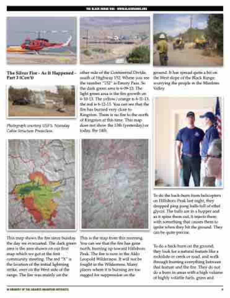
This map shows the fire since Sunday, the day we evacuated. The dark green area is the area shown on our first map which we got at the first community meeting. The red “X” is the location of the initial lightning strike, over on the West side of the range. The fire was mainly on the
other side of the Continental Divide, south of Highway 152. Where you see the number “152” is Emory Pass. So the dark green area is 6-09-13. The light green area is the fire growth on 6-10-13. The yellow/orange is 6-11-13, the red is 6-12-13. You can see that the fire has burned very close to Kingston. There is no fire to the north of Kingston at this time. This map does not show the 13th (yesterday) or today, the 14th.
This is the map from this morning. You can see that the fire has gone north, burning up toward Hillsboro Peak. The fire is now in the Aldo Leopold Wilderness. It will not be fought in the Wilderness. Many places where it is burning are too rugged for suppression on the
ground. It has spread quite a bit on the West slope of the Black Range, worrying the people in the Mimbres Valley.
To do the back-burn from helicopters on Hillsboro Peak last night, they dropped ping pong balls full of ethel glycol. The balls are in a hopper and as it spins them out, it injects them with something that causes them to ignite when they hit the ground. They can be quite precise.
To do a back-burn on the ground, they look for a natural feature like a rockslide or creek or road, and walk through burning everything between that feature and the fire. They do not do a burn in areas with a high volume of highly volatile fuels, grass and
IN MEMORY OF THE GRANITE MOUNTAIN HOTSHOTS
9
