
Page 42 - The Silver Fire
P. 42
THE BLACK RANGE RAG - WWW.BLACKRANGE.ORG
Flash Floods (Con’t)
Unfortunately we have a dam masquerading as a bridge to the west (upstream) of town. It is doubtful that the State of New Mexico will do anything about this bridge. (Taking out the bridge and making it a low- water crossing is probably the most effective thing which could be done to prevent, or mitigate, flooding in HIllsboro.) The bridge to the east of the State Road 27 junction presents a similar problem.
Given that we have a dam upstream and that the likelihood of flooding is increased, hardening the physical perimeter of the property you wish to protect is the next most effective thing that can be done to prevent damage. You should also have sand bags on hand, but remember you will not have much time. When it happens, hope the work you have done to protect your property will be sufficient and get out - protect yourself.
Good luck and don’t do anything which will make things worse. (Be aware of profiteers, they love situations like this.)
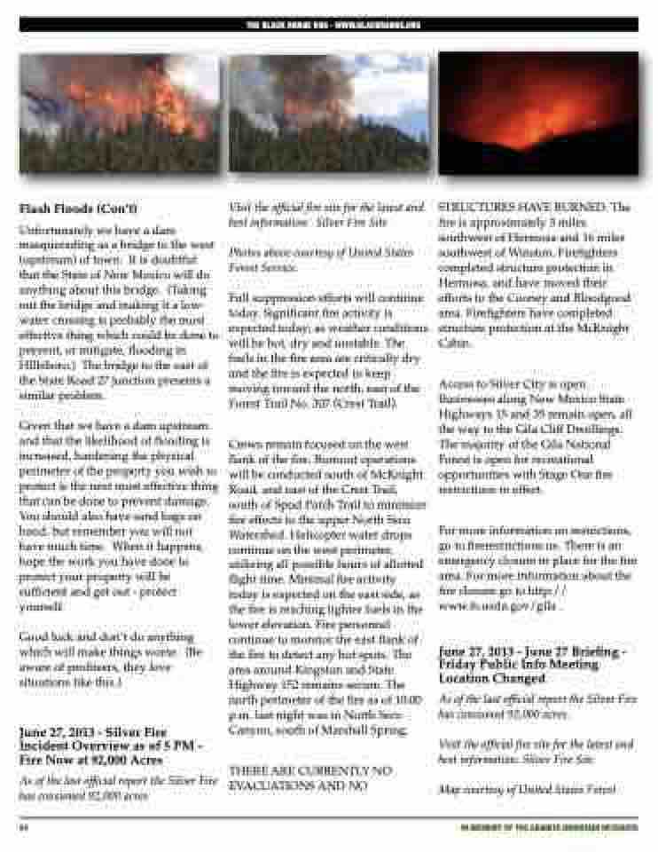
June 27, 2013 - Silver Fire Incident Overview as of 5 PM - Fire Now at 92,000 Acres
As of the last official report the Silver Fire has consumed 92,000 acres.
Visit the official fire site for the latest and best information: Silver Fire Site
Photos above courtesy of United States Forest Service.
Full suppression efforts will continue today. Significant fire activity is expected today; as weather conditions will be hot, dry and unstable. The fuels in the fire area are critically dry and the fire is expected to keep moving toward the north, east of the Forest Trail No. 307 (Crest Trail).
Crews remain focused on the west flank of the fire. Burnout operations will be conducted south of McKnight Road, and east of the Crest Trail, south of Spud Patch Trail to minimize fire effects to the upper North Seco Watershed. Helicopter water drops continue on the west perimeter, utilizing all possible hours of allotted flight time. Minimal fire activity today is expected on the east side, as the fire is reaching lighter fuels in the lower elevation. Fire personnel continue to monitor the east flank of the fire to detect any hot spots. The area around Kingston and State Highway 152 remains secure. The north perimeter of the fire as of 10:00 p.m. last night was in North Seco Canyon, south of Marshall Spring.
THERE ARE CURRENTLY NO EVACUATIONS AND NO
STRUCTURES HAVE BURNED. The fire is approximately 3 miles southwest of Hermosa and 16 miles southwest of Winston. Firefighters completed structure protection in Hermosa, and have moved their efforts to the Cooney and Bloodgood area. Firefighters have completed structure protection at the McKnight Cabin.
Access to Silver City is open. Businesses along New Mexico State Highways 15 and 35 remain open, all the way to the Gila Cliff Dwellings. The majority of the Gila National Forest is open for recreational opportunities with Stage One fire restrictions in effect.
For more information on restrictions, go to firerestrictions.us. There is an emergency closure in place for the fire area. For more information about the fire closure go to http:// www.fs.usda.gov/gila .
June 27, 2013 - June 27 Briefing - Friday Public Info Meeting Location Changed
As of the last official report the Silver Fire has consumed 92,000 acres.
Visit the official fire site for the latest and best information: Silver Fire Site
Map courtesy of United States Forest
42
iN MEMORY OF THE GRANITE MOUNTAIN HOTSHOTS
