
Page 44 - The Silver Fire
P. 44
THE BLACK RANGE RAG - WWW.BLACKRANGE.ORG
107,000 Acres - Incident Update of June 29 12:30 PM (Con’t)
reduce the fire's intensity. Fire crews will continue work on containing fire that spotted to the west and construction indirect fire line further out from fires edge on the west side of the fire within the Cooney Canyon area.
The south and east sides of the fire will be monitored by air as no fire activity has been detected for several days. Smoke observed on the east side of the fire is within the North Seco Canyon near the Forest Service boundary.
Current Situation
Total Personnel: 728
Size: 107,000 acres
Percent Contained: 35%
Fire Behavior: Plume dominated
fire behavior along the Northern and North Western perimeter
with long range spotting.
Significant Events: Five management action points have been preached in the last 24 hours.
Continue to hold, patrol, and mop- up as needed. IMT hosting a public meeting for the communities
in the Mimbres valley. Outlook
Planned Actions: Assess visibility to continue aerial firing operations to help reduce fire intensity
along the fire perimeter. Hold, patrol and mop-up as needed.
As of the last official report the Silver Fire has consumed 126,000 acres.
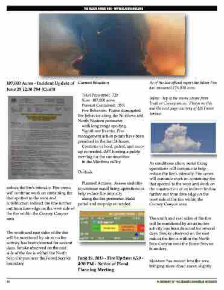
Below: Top of the smoke plume from Truth or Consequences. Photos on this and the next page courtesy of US Forest Service.
As conditions allow, aerial firing operations will continue to help reduce the fire's intensity. Fire crews will continue work on containing fire that spotted to the west and work on the construction of an indirect fireline further out from fires edge on the west side of the fire within the Cooney Canyon area.
The south and east sides of the fire will be monitored by air as no fire activity has been detected for several days. Smoke observed on the east side of the fire is within the North Seco Canyon near the Forest Service boundary.
Moisture has moved into the area bringing more cloud cover, slightly
44
iN MEMORY OF THE GRANITE MOUNTAIN HOTSHOTS
June 29, 2013 - Fire Update: 6/29 - 4:30 PM - Notice of Flood Planning Meeting
