
Page 34 - Ranger Demo
P. 34
precise requirements.5 This indicates that, during this time in London, Smyth sought out key figures in the world of practical science, and this too will not have escaped Hurd's notice.6 Hurd himself
provided Smyth with a theodolite, a micrometrical telescope, a sextant and a station-pointer – a basic tool-kit for boat surveys. The Board also allocated an Arnold chronometer.
Smyth left with guidance in a memorandum from the Hydrographer which laid great emphasis on the need to 'obtain accurate observations on the most material points'.7 Hurd had explained that he was unable to use most of the data which had come into the office from ships in the Mediterranean theatre because of the lack of good geodetic observations:
Our knowledge of the coasts and neighbourhood of Sicily is extremely deficient [...] We are also unacquainted with the true place of the important land-fall Maritimo, which, we are assured by experienced officers, is placed in the charts twenty miles too far to the westward [...] This, if true, constitutes a most serious error, as the Esquerques, Keith's Reef, and various other dangers, at present scarcely known, lie in the fair-way, and nearly mid-distance between the Sicilian and African shores [...] and there are some shoals supposed to exist on the southern and western coasts of Sicily, which it would be praiseworthy to search for, as many unaccountable losses and disappearances of vessels have taken place, at various times, in those parts.
Smyth himself had a clear vision of what was required. His contacts in London may have included officers of the Trigonometrical Survey who, in 1802, had measured an arc of the meridian from which charted latitudes and longitudes could be derived. Smyth set out with a 'design [...] of cutting a meridian through the island, and measuring a permanent base-line for the final determination of its true position, extent and form'.8
The Survey of Sicily gets underway
Once on the front line in Sicily
Smyth soon established that the
Neapolitan chart which Hurd had
given him of the main operating
area, the Strait of Messina, was full
of errors. He started work on a new
survey with substantial support: 'a
good vessel and crew were allotted
to me, and the stores of the arsenal
were at my requisition.'9 These
were nonetheless hectic and
turbulent times, and Smyth soon
grasped that his ideal survey plan
was unattainable. He was
interrupted by duties taking him to
the mainland as Napoleon's empire
collapsed. Smyth turned these
forays into good account to put in
place a network of observed
positions and 'chronometric arcs'
between them. 'Being obliged [...] to
resort to a secondary process, the
survey was executed on a
chronometric basis, connected with geodetical operations.'10
He would record later that: 'The utmost precision was used in laying down the astronomical data'. He shows a clear grasp of orders of precise observation, and methodologies to reduce systematic errors:
Many of the principal latitudes were taken onshore with the 9-inch quintant and artificial horizon, and
5 Smyth, Mediterranean, 354-6
6 Close, Early Years of the Ordnance Survey, xxiv, 46-9, 54, and 64 7 UKHO LB1, letter and memorandum dated 20 June 1816
8 Smyth, Memoir of Sicily, xiv
9 Smyth, Mediterranean, 356
10 Smyth, Memoir of Sicily, xv
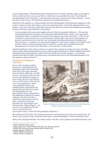
Figure 1 Detail from views in the Atlas of Sicily show Smyth and his military companions at work near Syracuse
32
