
Page 21 - PublicWorks-HA
P. 21
SURVEYING | MAPPING
H&A has one of the largest surveying operations in Southern California with more than 20 fully equipped, state-of-the- art survey crews led by certified party chiefs. Our mapping department is staffed with licensed surveyors who have extensive experience with property research and mapping procedures.
Overview
H&A has performed many square miles of design surveys within the past 10 years. Our staff uses a variety of data collection methods including traditional ground surveys, GPS positioning, aerial topography, LIDAR scanning, and aerial drones. Alone or in combination, this strategy results in the most cost effective and efficient outcome for each assignment. We have also provided construction surveying services and collection of as-built locations to a wide range of contractors and owners. Within the past 10 years H&A has also established several hundred miles of property boundaries and rights-of-way for sites of less than one acre to several square miles. Our research has often gone back over 100 years to document existing property lines and resolve variances between multiple data sources.
KEY FACTORS
• Project controls using traditional and GPS methodology
• Aerial and ground design surveys to document existing conditions
• Boundary and right-of-way surveys and analysis
• Legal descriptions and plats for recordation
• Record of Survey and ALTA documentation
• Construction staking for improvements
• As-builts and final monumentation
• Staff augmentation/plan checking for agencies
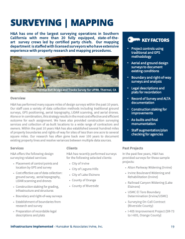
Thermal RxR Bridge and Tracks Survey for UPRR, Thermal, CA
Services
H&A offers the following design surveying related services:
• Placement of control points and location by GPS and survey
• Cost effective use of data collection: ground survey, aerial topography, LIDAR scanning and drones
• Construction staking for grading, infrastructure and structures
• Boundary and right-of-way surveys
• Establishment of boundaries from
research and survey
• Preparation of recordable legal descriptions and plats
Clients
H&A has recently performed surveys for the following selected clients:
• City of Irvine
• City of Laguna Hills • City of Lake Elsinore • County of Orange
• County of Riverside
Past Projects
In the past few years, H&A has provided surveys for these sample projects:
• Alton Parkway Widening (Irvine) • Irvine Boulevard Widening and
Rehabilitation (Irvine)
• Railroad Canyon Widening (Lake Elsinore)
• USMC El Toro Boundary Determination (Irvine/USMC)
• Surveying On-Call Contract (Riverside County)
• I-405 Improvement Project (SR-73 to I-605, Orange County)
Infrastructure Implemented - Hunsaker & Associates Irvine, Inc.
19
