
Page 21 - 2004 DT 9 Issues
P. 21
BOOT TRACKS by Tom Pfaendler
omeone once told me that they had off to the west, through the split-rail fence one of my favorite places at Red Rock.
hiked the White Rock Loop Trail and downhill along a bumpy old jeep road It’s a secluded, green forest quietly rest-
Stwo times. “The first time and the toward Willow Springs. You’ll quickly ing under the magnificent craggy north
last time.” OK, sure. It’s six miles long come to a trail sign that offers a nice side side of White Rock. I am always amazed
and a darn good workout. But I’d be hard trip down to the “Guzzler,” a man made at the difference between the north and
pressed to come up with a hike that I like water catchment that is a pretty spot for south faces of this mountain. Now would
much better! It has a hidden forest, rug- a picnic (I’m always thinking about be a good time to slow down to a stroll—
ged mountains, high vista scenery and food), but it will add another mile, so keep letting your senses dance along with the
low desert exploration, all rolled up into that in mind! The old road continues west breeze—and softly connect with this an-
a gorgeous half-day adventure. Simply along the foothills of White Rock Moun- cient forest.
put, it’s everything that you want in a Red tain, eventually turning into a footpath You’ll come to a little sign marking
Rock hike. and leading down through a the trail to La Madre
The trail can be accessed from three colorful wash and then Springs. That’s an-
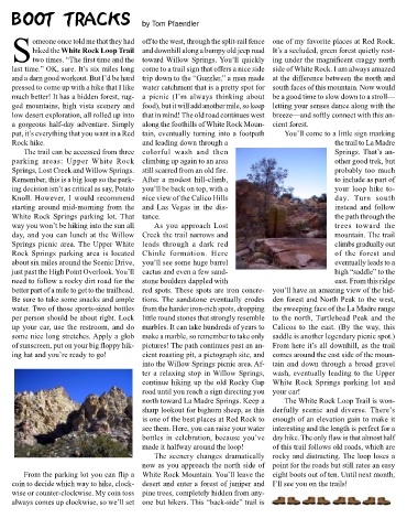
parking areas: Upper White Rock climbing up again to an area other good trek, but
Springs, Lost Creek and Willow Springs. still scarred from an old fire. probably too much
Remember, this is a big loop so the park- After a modest hill-climb, to include as part of
ing decision isn’t as critical as say, Potato you’ll be back on top, with a your loop hike to-
Knoll. However, I would recommend nice view of the Calico Hills day. Turn south
starting around mid-morning from the and Las Vegas in the dis- instead and follow
White Rock Springs parking lot. That tance. the path through the
way you won’t be hiking into the sun all As you approach Lost trees toward the
day, and you can lunch at the Willow Creek the trail narrows and mountain. The trail
Springs picnic area. The Upper White leads through a dark red climbs gradually out
Rock Springs parking area is located Chinle formation. Here of the forest and
about six miles around the Scenic Drive, you’ll see some huge barrel eventually leads to a
just past the High Point Overlook. You’ll cactus and even a few sand- high “saddle” to the
need to follow a rocky dirt road for the stone boulders dappled with east. From this ridge
better part of a mile to get to the trailhead. red spots. These spots are iron concre- you’ll have an amazing view of the hid-
Be sure to take some snacks and ample tions. The sandstone eventually erodes den forest and North Peak to the west,
water. Two of those sports-sized bottles from the harder iron-rich spots, dropping the sweeping face of the La Madre range
per person should be about right. Lock little round stones that strongly resemble to the north, Turtlehead Peak and the
up your car, use the restroom, and do marbles. It can take hundreds of years to Calicos to the east. (By the way, this
some nice long stretches. Apply a glob make a marble, so remember to take only saddle is another legendary picnic spot.)
of sunscreen, put on your big floppy hik- pictures! The path continues past an an- From here it’s all downhill, as the trail
ing hat and you’re ready to go! cient roasting pit, a pictograph site, and comes around the east side of the moun-
into the Willow Springs picnic area. Af- tain and down through a broad gravel
ter a relaxing stop in Willow Springs, wash, eventually leading to the Upper
continue hiking up the old Rocky Gap White Rock Springs parking lot and
road until you reach a sign directing you your car!
north toward La Madre Springs. Keep a The White Rock Loop Trail is won-
sharp lookout for bighorn sheep, as this derfully scenic and diverse. There’s
is one of the best places at Red Rock to enough of an elevation gain to make it
see them. Here, you can raise your water interesting and the length is perfect for a
bottles in celebration, because you’ve day hike. The only flaw is that almost half
made it halfway around the loop! of this trail follows old roads, which are
The scenery changes dramatically rocky and distracting. The loop loses a
now as you approach the north side of point for the roads but still rates an easy
From the parking lot you can flip a White Rock Mountain. You’ll leave the eight boots out of ten. Until next month,
coin to decide which way to hike, clock- desert and enter a forest of juniper and I’ll see you on the trails!
wise or counter-clockwise. My coin toss pine trees, completely hidden from any-
always comes up clockwise, so we’ll set one but hikers. This “back-side” trail is