
Page 59 - 2004 DT 9 Issues
P. 59
August visitor resources, and resource Hughes Corporation. The 5,032 acres
of Hughes land was exchanged for
protection.
With a very small Ranger staff, it about 3,000 acres south of the Can-
Desk Schedule
○ was obvious that to fulfill its mission, yon, providing a buffer for the Visitor
Sun/1 M. Gregory P. VanDooremaal ○ more hands would be needed. On May Center environment from ever-en-
○
Mon/2 A. Berg D. Kavula ○ ○ 14, 1984, Friends of Red Rock Can- croaching urbanization. (Another
Tues/3 M. Slagle J. Geier ○ ○ yon (FORRC) came together to help 1,000 acres was swapped in 2002
○
Wed/4 S. Stenzel C. Gilmore ○ out. Although the initial group was along the eastern boundary.)
○
Thur/5 J. Barrett Closed at noon ○ ○ very small, it was composed of dedi- In 1990, more help arrived. Sena-
Fri/6 D./V. Wray E. Schliepp ○ ○ cated and astute local citizens who tor Harry Reid wrote legislation to turn
○
Sat/7 E. Meeks G. Gabbert ○ began to make an immediate impact. the 62,000 acre RRCRL into the Red
○
Sun/8 B. Saperstein D. Gillette ○ ○ By September, FORRC received its Rock Canyon National Conservation
Mon/9 P. Grand S. Stenzel ○ ○ official charter from
○
Tues/10 J. Frank J. Geier ○ BLM and on August 19,
○
Wed/11 R. Augulis M. Gregory ○ ○ 1985, was incorporated.
Thur/12 N. Kresge J. Barrett ○ ○ In addition to volun-
Fri/13 D./V. Wray M. Rosow ○ ○ teer staff assistance, the
○
Sat/14 OPEN OPEN ○ ○ BLM needed a way to
Sun/15 M. Gregory D. Gillette ○ ○ fund many of the services
○
Mon/16 S. Stenzel F. Rhea ○ required by their mandate.
○
Tues/17 M. Slagle J. Geier ○ ○
FORRC began raising
Wed/18 D./V. Wray C. Gilmore ○ ○ money for projects
○
Thur/19 J. Frank J. Barrett ○
Fri/20 D./V. Wray E. Schliepp ○ ○ ○ through book and T-shirt
Sat/21 J. Kisosondi OPEN ○ sales, and events. But a
○ permanent bookstore
○
Sun/22 OPEN M./L. Utah ○
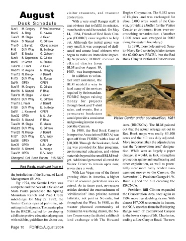
Mon/23 S. Stenzel F. Rhea ○ ○ ○ would provide a consistent Visitor Center under constructiion, 1981
Tues/24 M. Slagle E. Meeks ○ and growing income to sup- Area (RRCNCA). The BLM pointed
○
Wed/25 D./V. Wray C. Gilmore port the Canyon. out that the actual acreage set out in
Thur/26 N. Kresge J. Barrett In 1988, the Red Rock Canyon Red Rock maps was really 83,100
Fri/27 D./V. Wray D./V. Wray Interpretive Association (RRCIA) was acres and the bill was duly adjusted.
Sat/28 OPEN OPEN spun off from FORRC with a loan of More important than the adjusted area
Sun/29 OPEN L./M. Utah $10,000. Through the bookstore, fund- was the “conservation area” designa-
Mon/30 S. Stenzel N. Kresge ing was provided for hike programs,
Tues/31 OPEN D./V. Wray environmental education, and visitor tion. While seen as largely a paper
materials beyond the small BLM bud- change, it would, in fact, strengthen
Changes? Call Scott Bahan, 515-5371
get. Additional personnel allowed the protection against mineral leasing and
Visitor Center to remain open now, other exploitation, as well as poten-
Red Rock, continued from p.1
seven days a week. tially stear more badly needed man-
With Las Vegas one of the fastest agement money to the Canyon. On
the jurisdiction of the Bureau of Land
growing cities in America, a higher November 19, President George H. W.
Management (BLM).
level of resource protection was re- Bush signed the bill creating the
By 1974, the Scenic Drive was
complete and the Nevada Division of quired. As in times past, newspaper RRCNCA.
articles decried the encroachment of President Bill Clinton expanded
State Parks purchased the Spring
Mountain Ranch and Pine Creek “civilization” into pristine natural the Conservation Area once again in
inholdings. On May 22, 1982, the habitats, not just in Nevada, but 1994, more than doubling its size. With
Visitor Center opened part-time, ad- throughout the West. In 1988, as the almost 197,000 acres under its banner,
mitting its first guests. The master plan master planned community of the NCA stretches from the Birdspring
for the RRCRL called for developing Summerlin was being drawn, the Na- Range south of Cottonwood Canyon
a full interpretive educational program ture Conservancy facilitated a difficult to the lower slopes of Mt. Charleston,
with exhibits, guidelines for visitor use, land exchange with The Howard ending at Lee Canyon Road. The new
Page 10 FORRC/August 2004