
Page 208 - G5.1_M1-5
P. 208
DO NOT EDIT--Changes must be made through “File info”
CorrectionKey=TX-A
myNotes
Sinking Islands
9 The corals weren’t the only evidence of underground rumblings in
Indonesia. The Sunda Megathrust Fault at the bottom of the Indian
Ocean marks the collision between two of the plates that make up the
earth’s surface, one oceanic, the other continental. Between earthquakes,
the plates are stuck together. As the oceanic plate slips slowly
downward, it squeezes the continental plate sideways about half an inch
a year, and drags it down a few inches a year as well. The islands on top
of the continental plate are dragged down too, as much as half an inch a
year. The more years between earthquakes, the more the islands sink—
and the more stress builds up at the fault.
10 The islanders could tell that the water line was shifting. “They can
see their boardwalks and harbors sinking,” Sieh said. Trees that once
grew tall on shore were now underwater, and wells that once gave
freshwater were full of salty seawater instead. But no one thought that
this had anything to do with earthquakes or tsunamis.
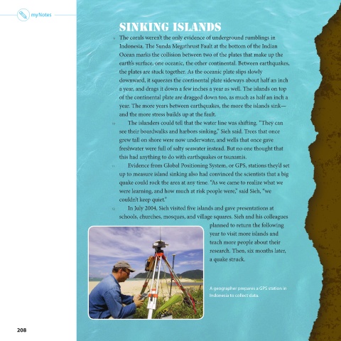
11 Evidence from Global Positioning System, or GPS, stations they’d set
up to measure island sinking also had convinced the scientists that a big
quake could rock the area at any time. “As we came to realize what we
were learning, and how much at risk people were,” said Sieh, “we
couldn’t keep quiet.”
12 In July 2004, Sieh visited five islands and gave presentations at
schools, churches, mosques, and village squares. Sieh and his colleagues
planned to return the following
year to visit more islands and
teach more people about their
research. Then, six months later,
a quake struck.
A geographer prepares a GPS station in
Indonesia to collect data.
208