
Page 113 - maintg
P. 113
ALASKA
Share the Wonder
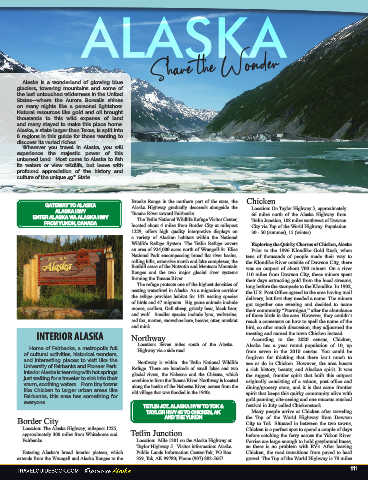
Alaska is a wonderland of glowing blue
glaciers, towering mountains and some of
the last untouched wilderness in the United
States—where the Aurora Borealis shines
on many nights like a personal lightshow.
Natural resources like gold and oil brought
thousands to this wild expanse of land
and many stayed to make this place home.
Alaska, a state larger than Texas, is split into
6 regions in this guide for those wanting to
discover its varied riches.
Wherever you travel in Alaska, you will
experience the majestic power of this
untamed land. Most come to Alaska to fish
its waters or view wildlife, but leave with
profound appreciation of the history and
culture of the unique 49 State.
th
Brooks Range in the northern part of the state, the Chicken
GATEWAY TO ALASKA Alaska Highway gradually descends alongside the Location: On Taylor Highway 5, approximately
ALASKA HWY Tanana River toward Fairbanks. 66 miles north of the Alaska Highway from
ENTER ALASKA VIA ALASKA HWY The Tetlin National Wildlife Refuge Visitor Center, Tetlin Junction, 108 miles southwest of
FROM YUKON, CANADA located about 4 miles from Border City at milepost Dawson City via Top of the World Highway.
1229, offers high quality interpretive displays on Population 30 - 50 (summer), 15 (winter).
a variety of Alaskan habitats within the National
Wildlife Refuge System. The Tetlin Refuge covers Exploring the Quirky Charms of Chicken,
an area of 924,000 acres north of Wrangell-St. Elias Alaska
National Park encompassing broad flat river basins, Prior to the 1896 Klondike Gold Rush, when
rolling hills, extensive marsh, and lake complexes, the tens of thousands of people made their way to the
foothill areas of the Nutzotin and Mentasta Mountain Klondike River outside of Dawson City, there was
Ranges and the two major glacial river systems an outpost of about 400 miners. On a river 110 miles
forming the Tanana River. from Dawson City, these miners spent their days
The refuge protects one of the highest densities of extracting gold from the local streams, long before
nesting waterfowl in Alaska. As a migration corridor the stampede to the Klondike. In 1902, the U.S. Post
the refuge provides habitat for 143 nesting species Office agreed to the area having mail delivery, but
of birds and 47 migrants. Big game animals include first they needed a name. The miners got together
moose, caribou, Dall sheep, grizzly bear, black bear, one evening and decided to name their community
and wolf. Smaller species include lynx, wolverine, “Ptarmigan,” after the abundance of those birds in
red fox, marten, snowshoe hare, beaver, otter, the area. However, they couldn’t reach a consensus
muskrat, and mink. on how to spell the name of the bird, so after much
INTERIOR ALASKA Northway discussion, they adjourned the meeting and named
the town Chicken instead.
Location: Seven miles south of the Alaska According to the 2020 census, Chicken, Alaska
Home of Fairbanks, a metropolis full Highway via a side road. has a year round population of 10, up from seven in
of cultural activities, historical wonders, the 2010 census. You could be forgiven for thinking
and interesting places to visit like the Northway is within the Tetlin National Wildlife that there isn’t much to see or do in Chicken.
University of Fairbanks and Pioneer Park. Refuge. There are hundreds of small lakes and two However, the area boasts a rich history, beauty, and
Interior Alaska is teeming with hot springs glacial rivers, the Nabesna and the Chisana, which Alaskan spirit. It was the rugged, frontier spirit that
just waiting for a traveler to sink into their combine to form the Tanana River. Northway is located built this outpost originally consisting of a saloon,
warm, soothing waters. From tiny towns along the banks of the Nabesna River, across from the post office, roadhouse and general store, and it
like Chicken to larger urban areas like old village that was flooded in the 1940s. is that same frontier spirit that keeps this quirky
Fairbanks, this area has something for community alive with gold panning, site-seeing,
everyone.
TETLIN JCT. ALASKA HYW TO TOK & and one raucous musical festival in June called
TAYLOR HWY #5 TO CHICKEN, AK Chickenstock.
Many people arrive at Chicken after traveling
Border City AND THE YUKON the Top of the World Highway from Dawson City
Location: The Alaska Highway, milepost 1225, to Tok. Situated in between the two towns, Chicken
approximately 300 miles from Whitehorse and Tetlin Junction is a perfect spot to spend a couple of days before
Fairbanks. Location: Mile 1301 on the Alaska Highway at catching the ferry across the Yukon River. Ferries
Taylor Highway 5. Visitor information: Alaska are large enough to hold greyhound buses, so there
Entering Alaska’s broad interior plateau, which Public Lands Information Center-Tok, PO Box is no problem with RVs. After leaving Chicken, the
extends from the Wrangell and Alaska Ranges to the 359, Tok, AK 99780; Phone (907) 883-5667. road transitions from paved to hard gravel. The Top
111