
Page 88 - CTB-1 10 May
P. 88
88 PIONEERING A NEW FUTURE
L-R: Women slivering bamboo
Communication through Software Defined Radio (SDR)
Coastal Mapping for INCOIS using UAV
Ground sampling of crops for acreage estimation under PMFBY
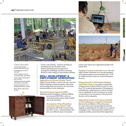
Erosion analysis of Brahmaputra River using UAV
Initiating telemedicine through high speed wireless communication
Mapping of Eucalyptus for ITC through NECTAR's Aero II Model
Below: Bamboo timbre-based furniture
• Colour code marking – maturity marking for identifying the age of bamboo culm.
• Bamboo-planting material using micro- propagation technology and flute technology known as culm cutting or stem-setting technique.
SKILL DEVELOPMENT & EMPLOYMENT GENERATION Applications for Internal Security: The 3D Digital Terrain Models, used for both ops room and field for planning counter insurgency operations and launching field operations by the state police and paramilitary forces, developed.
Watershed Analysis Support for MBDA:
Meghalaya Basin Development Authority (MBDA) has entrusted NECTAR to carry out
watershed analysis project using available data in the first phase.
Development of Fixed-Wing Micro Unmanned Aerial Vehicles: UAVs developed by NECTAR are fixed-wing
type Micro-UAV, a self-guided plane that can carry different types of consumer
sensors and capture geo-tagged photographs with inbuilt GPS.
Mapping of Tsunami Vulnerable Areas: The 500 sqkm tsunami vulnerable area was photographed and mapped using in-house developed micro-UAV for Indian National Centre for Ocean Information Services.
Brahmaputra River Embankment Mapping and Erosion Study: A case study on generation of Digital Surface Model (DSM) & Land Use data from UAV acquired photographs of Brahmaputra embankments comprising area of about 50 sqkm was accomplished for the Government of Assam to demonstrate the visualization of flood-related disaster and its mitigation.
Mahanadi-Barmul Reservoir Survey and Study
of Water Submergence using RPAS Technology: Entrusted by the Ministry of Water Resources,
the scope of the project involved high precision 3D mapping of approximately 450 sqkm area to study the submergence area. The project had a feasible survey component of link canal of about 20 km length from
