
Page 173 - THE MELANESIA DIASPORA FILE CETAK ISI 10022017
P. 173
N
NORTH MALUKU PROVINCE
Moratai Island
WAYABULA
TOBELO
TELUK KAO HALMAHERA SEA
Notes: JAILOLO
Hiri Island
TERNATE Ternate Island SOFIFI MABA TELUK BULI
TERNATE
Maitara Island
Tidore Island SOASIO
TIDORE ISLANDS Mare Island
Moti Island
WEST HALMAHERA Makian Island WEDA
TELUK WEDA
NORTH HALMAHERA Kayoa Island
MALUKU SEA
MOROTAI ISLAND Gebe Island
EAST HALMAHERA
CENTRAL HALMAHERA LABUHA
SOUTH HALMAHERA Bacan Island
SULA ISLANDS
Obi Island
Mangoli Island
SANANA
SERAM SEA
Sulabesi Island
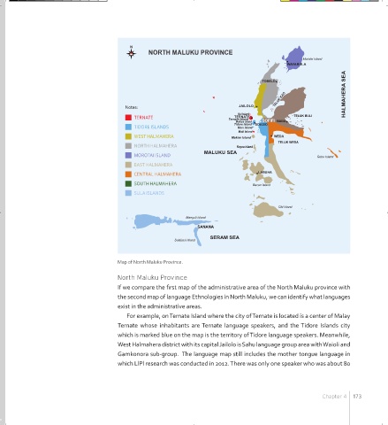
Map of North Maluku Province.
North Maluku Province
If we compare the first map of the administrative area of the North Maluku province with
the second map of language Ethnologies in North Maluku, we can identify what languages
exist in the administrative areas.
For example, on Ternate Island where the city of Ternate is located is a center of Malay
Ternate whose inhabitants are Ternate language speakers, and the Tidore Islands city
which is marked blue on the map is the territory of Tidore language speakers. Meanwhile,
West Halmahera district with its capital Jailolo is Sahu language group area with Waioli and
Gamkonora sub-group. The language map still includes the mother tongue language in
which LlPl research was conducted in 2012. There was only one speaker who was about 80
Chapter 4 173
MELANESIA BOOK FA LAYOUT 051216.indd 173 2/10/17 2:10 PM