
Page 61 - NSAA_Winter_2017_WEB
P. 61
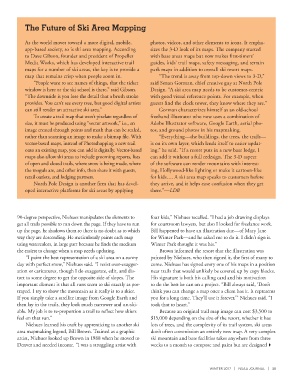
The Future of Ski Area Mapping


            As the world moves toward a more digital, mobile,   photos, videos, and other elements to icons. It empha-
            app-based society, so is ski area mapping. According   sizes the 3-D look of its maps. The company started
            to Dave Gibson, founder and president of Propeller   with base areas maps but now makes first-timers’
            Media Works, which has developed interactive trail   guides, kids’ trail maps, safety messaging, and terrain
            maps for a number of ski areas, the key is to provide a   park maps in addition to overall ski resort maps.
            map that remains crisp when people zoom in.            “The trend is away from top-down views to 3-D,”
               “People want to see names of things, that the ticket   said Senan Gorman, chief creative guy at North Pole
            window is here or the ski school is there,” said Gibson.   Design. “A ski area map needs to be customer-centric
            “The downside is you lose the detail that a brush stroke   with good visual reference points. For example, when
            provides. You can’t see every tree, but good digital artists   guests find the clock tower, they know where they are.”
            can still render an attractive ski area.”              Gorman characterizes himself as an old-school
               To create a trail map that won’t pixelate regardless of   freehand illustrator who now uses a combination of
            size, it must be produced using “vector artwork,” i.e., an   Adobe Illustrator software, Google Earth, aerial pho-
            image created through points and math that can be scaled,   tos, and ground photos in his mapmaking.
            rather than scanning an image to make a bitmap file. With   “Everything—the buildings, the trees, the trails—
            vector-based maps, instead of Photoshopping a new trail   is on its own layer, which lends itself to easier updat-
            onto an existing map, you can add it digitally. Vector-based   ing,” he said. “If a resort puts in a new base lodge, I
            maps also allow ski areas to include grooming reports, lists   can add it without a full redesign. The 3-D aspect
            of open and closed trails, where snow is being made, where   of the software can render mountains with interest-
            the moguls are, and other info, then share it with guests,   ing, Hollywood-like lighting or make it cartoon-like
            retail outlets, and lodging partners.               for kids…. A ski area map speaks to customers before
               North Pole Design is another firm that has devel-  they arrive, and it helps ease confusion when they get
            oped interactive platforms for ski areas by applying   there.”—LDB


        90-degree perspective, Niehues manipulates the elements to   four kids,” Niehues recalled. “I had a job drawing displays
        get all trails possible to run down the page. If they have to run   for courtroom lawyers, but also I looked for freelance work.
        up the page, he shadows them so there is no doubt as to which   Bill happened to have an illustration due—of Mary Jane
        way they are descending. He meticulously paints each map   for Winter Park—and he asked me to do it. I didn’t sign it.
        using watercolors, in large part because he finds the medium   Winter Park thought it was his.”
        the easiest to change when a map needs updating.            Brown informed the resort that the illustration was
            “I paint the best representation of a ski area on a sunny   painted by Niehues, who then signed it, the first of many to
        day with perfect snow,” Niehues said. “I resist over-exagger-  come. Niehues has signed every one of his maps in a position
        ation or caricatures, though I do exaggerate, edit, and dis-  near trails that would unlikely be covered up by copy blocks.
        tort to some degree to get the opposite side of slopes. The   His signature is both his calling card and his motivation
        important element is that all runs seem to ski exactly as por-  to do the best he can on a project. “Bill always said, ‘Don’t
        trayed. I try to show the mountain as it really is to a skier.   think you can change a map once a client has it. It represents
        If you simply take a satellite image from Google Earth and   you for a long time. They’ll use it forever,’” Niehues said. “I
        then lay in the trails, they look much narrower and un-ski-  took that to heart.”
        able. My job is to re-proportion a trail to reflect how skiers   Because an original trail map image can cost $3,500 to
        feel on that run.”                                      $15,000 depending on the size of the resort, whether it has
            Niehues learned his craft by apprenticing to another ski   lots of trees, and the complexity of its trail system, ski areas
        area mapmaking legend, Bill Brown. Trained as a graphic   don’t often commission an entirely new map. A very complex
        artist, Niehues looked up Brown in 1988 when he moved to   ski mountain and base facilities takes anywhere from three
        Denver and needed income. “I was a struggling artist with   weeks to a month to compose and paint but are designed


                                                                                         WINTER 2017  |  NSAA JOURNAL  |  59