
Page 32 - Clackamas County Watertourism Strategic Plan. Final.v3
P. 32
STRATEGIC PLAN FOR WATER-BASED TOURISM IN CLACKAMAS COUNTY, OREGON THE WATER
3-14
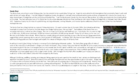
Sandy River
The Sandy River, according to some fishing guides, has the potential to be a world class fishing river. It gets its name after the Mt Hood glacier that consistently feeds it with cold
and nutrient-rich water all year. From the ceiling of Clackamas County, the glacier’s melt will collect sediment and minerals and flow unimpeded 40.5 miles to the County line, 2
miles downstream of Dodge Park and the confluence of the Bull Run. From the Multnomah County line, the river will flow another 16.5 miles and empty into the Columbia River
at Troutdale. The river welcomes most of its Clackamas County visitors between the Salmon River confluence in Mt Hood Village and Dodge Park, or between river miles 38 and
18.5. Clackamas County has 20 miles of superb fishing, exciting whitewater, inviting flatwater, and remote riparian wilderness all within an hour’s drive from the Portland
metropolitan area.
The Sandy River has a long tradition as a popular fishing destination. On warm summer days in the early 1900s, the railroad would bring
iii
hundreds of visitors from Portland to the river shores near Dodge Park to picnic, fish and relax . The tradition of the Sandy River as a
recreation destination is almost as old as Oregon. The river is known for its Salmon and Steelhead runs. Historically, the runs were as high
iv
as 15,000 coho, 20,000 winter steelhead, 10,000 fall chinook and 8,000 to 10,000 spring chinook . These fish still return to the river, but
the runs are far below historic levels. Historic hatchery records, along with recent spawning surveys in the Salmon and Zigzag watersheds,
v
suggest that current spawning returns are only 10-25 percent of 1890s levels . In October 2007, the Marmot Dam (RM30.5) was removed,
and many fishing guides and river managers are hopeful for a return of the glory days of the Sandy River.
In addition to world class fishing, the Sandy is renowned for its challenging whitewater section. The Sandy River gorge offers 6 miles of
some of the most difficult whitewater in Oregon and Pacific Northwest. Once a boater floats past Marmot Park (RM 30.5) the canyon becomes so steep and inaccessible that the
1
only option to get off the river is to navigate (and survive) several Class 4 and 5 rapids until the river is accessible by road again at LaTourete Park (RM19.5). While this level of
challenge limits the market size to a small minority of users, it still creates a highly unique experience. River outfitters specializing in
whitewater runs have a great opportunity to open a new market. BLM managed Marmot Park offers excellent put-in access and take out
could occur at the underutilized LaTourette Park managed by the County.
Although the fishing, paddling, camping, picnicking and hiking opportunities are superb in this stretch of river, visitors are challenged with
significant limitation to access. Other than Marmot Park and Dodge Park there are very few opportunities to get on the water. Dodge Park
is 14 acres on the confluence of Sandy and the Bull Run. Here, there are 20 camping sites on shady grass and a boat launch. Marmot Park
is a wide open grassy day use area with bathrooms, parking and walking trails. The BLM has identified the area at the confluence of the
Sandy and Salmon rivers as a future river access site, however, there are no published plans or budget for this today. In this vicinity, there
1 Based on an International Scale of River Difficulty established by the American Whitewater Association Class level reflects the technical difficulty and skill level required with Class 1 being the easiest and Class 5
being the most difficult.