
Page 25 - NYS_ESS_05-2025
P. 25
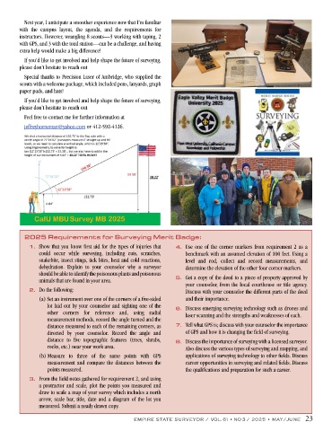
Next year, I anticipate a smoother experience now that I’m familiar
        with the campus layout, the agenda, and the requirements for
        instructors. However, wrangling 8 scouts—3 working with taping, 2
        with GPS, and 3 with the total station—can be a challenge, and having
        extra help would make a big difference!
          If you’d like to get involved and help shape the future of surveying,
        please don’t hesitate to reach out
          Special thanks to Precision Laser of Ambridge, who supplied the
        scouts with a welcome package, which included pens, lanyards, graph
        paper pads, and hats!
          If you’d like to get involved and help shape the future of surveying,
        please don’t hesitate to reach out
          Feel free to contact me for further information at
          jeffreyhorneman@yahoo.com or 412-592-4126.


          2025 Requirements for Surveying Merit Badge:
            1.  Show that you know first aid for the types of injuries that   4.  Use one of the corner markers from requirement 2 as a
               could occur while surveying, including cuts, scratches,   benchmark with an assumed elevation of 100 feet. Using a
               snakebite, insect stings, tick bites, heat and cold reactions,   level and rod, collect and record measurements, and
               dehydration. Explain to your counselor why a surveyor   determine the elevation of the other four corner markers.
               should be able to identify the poisonous plants and poisonous
               animals that are found in your area.               5.  Get a copy of the deed to a piece of property approved by
                                                                     your counselor, from the local courthouse or title agency.
            2.  Do the following:                                    Discuss with your counselor the different parts of the deed
               (a)  Set an instrument over one of the corners of a five-sided   and their importance.
                  lot laid out by your counselor and sighting one of the   6.  Discuss emerging surveying technology such as drones and
                  other corners for reference and, using radial      laser scanning and the strengths and weaknesses of each.
                  measurement methods, record the angle turned and the
                  distance measured to each of the remaining corners, as   7.  Tell what GPS is; discuss with your counselor the importance
                  directed by your counselor. Record the angle and   of GPS and how it is changing the field of surveying.
                  distance to five topographic features (trees, shrubs,   8.  Discuss the importance of surveying with a licensed surveyor.
                  rocks, etc.) near your work area.                  Also discuss the various types of surveying and mapping, and
               (b)  Measure to three of the same points with GPS     applications of surveying technology to other fields. Discuss
                   measurement and compare the distances between the   career opportunities in surveying and related fields. Discuss
                   points measured.                                  the qualifications and preparation for such a career.
            3.  From the field notes gathered for requirement 2, and using
               a protractor and scale, plot the points you measured and
               draw to scale a map of your survey which includes a north
               arrow, scale bar, title, date and a diagram of the lot you
               measured. Submit a neatly drawn copy.

                                                   EMPIRE STATE SURVEYOR / VOL. 61 • NO 3 / 2025 • MAY/JUNE   23