
Page 794 - NGTU_paper_withoutVideo
P. 794
Modern Geomatics Technologies and Applications
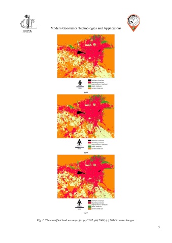
(a)
(b)
(c)
Fig. 1. The classified land use maps for (a) 2002, (b) 2008, (c) 2014 Landsat images.
3