
Page 18 - Fortier Family History
P. 18
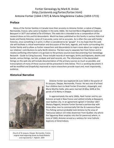
1709 Map of Quebec Colony with île d'Orléans Cadastral map of Québec city region, 1709, from Bibliothèque et Archives nationales du Québec (BAnQ); A few years later, on 1 March 1671 (Notary Rageot), Antoine signed a contract for ownership of land on nearby Île-d'Orléans. The land consisted of three arpents of frontage (1 arpent = 192 feet) on the St- Lawrence River. This is probably the same strip of land labeled "Ouers Fortiers" (Fortier heirs) on the 1709 cadastral map of Île-d'Orléans (below) that is located in the parish of St-Laurent. (At the time of Antoine's initial settlement here, this was part of Ste-Famille parish. Another parish, St-Paul, was formed on the southwestern side of the island in 1679. St-Paul was renamed to St-Laurent in 1698.)
