
Page 117 - Walks In The Black Range
P. 117
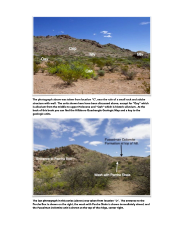
  The photograph above was taken from location “C”, near the ruin of a small rock and adobe structure with well. The units shown here have been discussed above, except for “Qay” which is alluvium from the middle to upper Holocene and “Qah” which is historic alluvium. At the back of this book you can find the Hillsboro Quadrangle Geologic Map and a key to the geologic units.
 The last photograph in this series (above) was taken from location “D”. The entrance to the Percha Box is shown on the right, the wash with Percha Shale is shown immediately ahead, and the Fusselman Dolomite unit is shown at the top of the ridge, center right.
