
Page 123 - Walks In The Black Range
P. 123
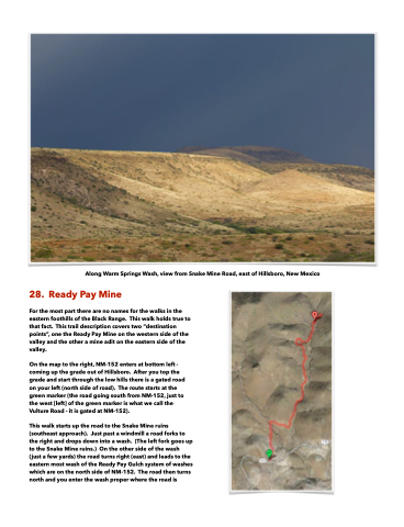
 Along Warm Springs Wash, view from Snake Mine Road, east of Hillsboro, New Mexico
28. Ready Pay Mine
For the most part there are no names for the walks in the eastern foothills of the Black Range. This walk holds true to that fact. This trail description covers two “destination points”, one the Ready Pay Mine on the western side of the valley and the other a mine adit on the eastern side of the valley.
On the map to the right, NM-152 enters at bottom left - coming up the grade out of Hillsboro. After you top the grade and start through the low hills there is a gated road on your left (north side of road). The route starts at the green marker (the road going south from NM-152, just to the west [left] of the green marker is what we call the Vulture Road - it is gated at NM-152).
This walk starts up the road to the Snake Mine ruins (southeast approach). Just past a windmill a road forks to the right and drops down into a wash. (The left fork goes up to the Snake Mine ruins.) On the other side of the wash (just a few yards) the road turns right (east) and leads to the eastern most wash of the Ready Pay Gulch system of washes which are on the north side of NM-152. The road then turns north and you enter the wash proper where the road is
