
Page 125 - Walks In The Black Range
P. 125
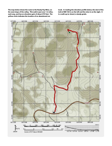
 The map below shows the route to the Ready Pay Mine, on the west slope of the valley. This walk is just over 1.2 miles, each way, and has an elevation gain of about 375 feet. The yellow circle indicates the location of an abandoned ore
truck. In reading the elevation profile below, the start of the trail at NM-152 is on the left and the mine is on the right. It is a walk up (or down) a steady grade.
