
Page 129 - Walks In The Black Range
P. 129
30. South of the Opportunity
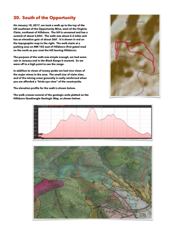
On January 18, 2017, we took a walk up to the top of the hill southeast of the Opportunity Mine, west of the Virginia Claim, northeast of Hillsboro. The hill is unnamed and has a summit of about 5,856’. The walk was about 2.2 miles and has an elevation gain of about 360’. It is shown in red on the topographic map to the right. The walk starts at a parking area on NM-152 east of Hillsboro (first gated road on the north as you crest the hill leaving Hillsboro).
The purpose of the walk was simple enough, we had some rain in January and in the Black Range it snowed. So we were off to a high point to see the range.
In addition to views of snowy peaks we had nice views of the major mines in the area. The small size of claim sites, and of the mining areas generally is really reinforced when you are afforded a “birds eye view” of the countryside.
The elevation profile for the walk is shown below.
The walk crosses several of the geologic units platted on the Hillsboro Quadrangle Geologic Map, as shown below.
