
Page 130 - Walks In The Black Range
P. 130
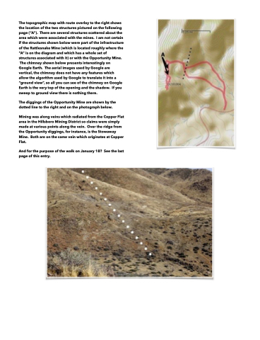
  The topographic map with route overlay to the right shows the location of the two structures pictured on the following page (“A”). There are several structures scattered about the area which were associated with the mines. I am not certain if the structures shown below were part of the infrastructure of the Rattlesnake Mine (which is located roughly where the “A” is on the diagram and which has a whole set of structures associated with it) or with the Opportunity Mine.
The chimney shown below presents interestingly on Google Earth. The aerial images used by Google are vertical, the chimney does not have any features which allow the algorithm used by Google to translate it into a “ground view”, so all you can see of the chimney on Google Earth is the very top of the opening and the shadow. If you sweep to ground view there is nothing there.
The diggings of the Opportunity Mine are shown by the dotted line to the right and on the photograph below.
Mining was along veins which radiated from the Copper Flat area in the Hillsboro Mining District so claims were simply made at various points along the vein. Over the ridge from the Opportunity diggings, for instance, is the Stowaway Mine. Both are on the same vein which originates at Copper Flat.
And for the purpose of the walk on January 18? See the last page of this entry.
