
Page 134 - Walks In The Black Range
P. 134
31. Rattlesnake Mine
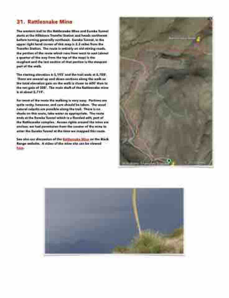
The western trail to the Rattlesnake Mine and Eureka Tunnel starts at the Hillsboro Transfer Station and heads northwest before turning generally northeast. Eureka Tunnel, in the upper right hand corner of this map is 2.3 miles from the Transfer Station. The route is entirely on old mining roads, the portion of the route which runs from west to east (about a quarter of the way from the top of the map) is the roughest and the last section of that portion is the steepest part of the walk.
The starting elevation is 5,195’ and the trail ends at 5,788’. There are several up and down sections along the walk so
the total elevation gain on the walk is closer to 600’ than to the net gain of 508’. The main shaft of the Rattlesnake mine is at about 5,719’.
For most of the route the walking is very easy. Portions are quite rocky, however, and care should be taken. The usual natural culprits are possible along the trail. There is no shade on this route, take water as appropriate. The route ends at the Eureka Tunnel which is a flooded adit, part of the Rattlesnake complex. Access rights around the mine are unclear, we had permission from the curator of the mine to enter the Eureka Tunnel at the time we mapped this route.
See also our discussion of the Rattlesnake Mine on the Black Range website. A video of the mine site can be viewed here.
