
Page 136 - Walks In The Black Range
P. 136
33. Bigelow Mine
There are a number of variations in the spelling of this mine’s name; Bigelowe, Bigelow, and Big-Lo being the major variants that you are likely to encounter. This trail starts at the Hillsboro Transfer Station and follows an old mining road for a little over 2.1 miles (4.2 miles RT) on the route depicted in the first map which follows or alternatively via Route 2 for about 2.35 miles (4.7 miles RT) on the second map. This “trail” ends at the shafts of the Bigelow Mine. The net elevation gain is about 400 feet, there is some up and down along the road so the gross gain/loss in elevation is somewhat greater than 430 feet. The mine is at an elevation of 5,677 feet. Information about the mine may be found here (includes video).
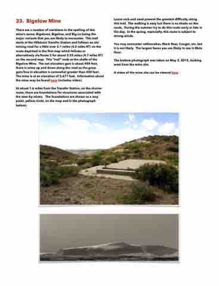
At about 1.6 miles from the Transfer Station, on the shorter route, there are foundations for structures associated with the near-by mines. The foundations are shown as a way point, yellow circle, on the map and in the photograph below).
Loose rock and sand present the greatest difficulty along this trail. The walking is easy but there is no shade on the route. During the summer try to do this route early or late in the day. In the spring, especially, this route is subject to strong winds.
You may encounter rattlesnakes, Black Bear, Cougar, etc. but it is not likely. The largest fauna you are likely to see is Mule Deer.
The bottom photograph was taken on May 3, 2015, looking west from the mine site.
A video of the mine site can be viewed here.
