
Page 64 - Vol 2 Walks In The Black Range Eastern Foothills South
P. 64
In much of this area, land ownership is very clear, it is federal (whether leased or not). In some cases it is not clear where the ownership rests. Even, as in the case of this route, where there were no postings it is prudent to ask around and ask permission if that is necessary.
The route is shown to the right, the photo was taken from the ridge west of the Hillsboro Cemetery. It climbs gradually to the high point, goes down hill into a wash, and joins a track for the return to NM-152, west of Hillsboro.
In the second photo to the right, taken at roughly the point where the route turns back to the right in the “route photo” to the right, the high point of the route is on the ridge line at the left.
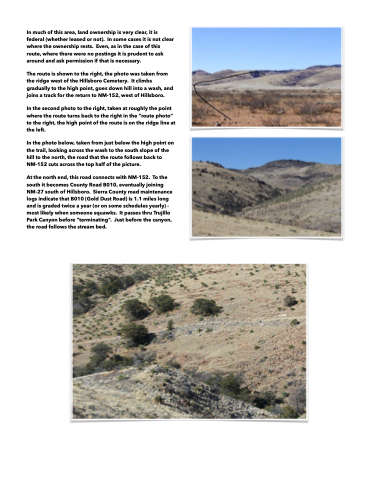
In the photo below, taken from just below the high point on the trail, looking across the wash to the south slope of the hill to the north, the road that the route follows back to NM-152 cuts across the top half of the picture.
At the north end, this road connects with NM-152. To the south it becomes County Road B010, eventually joining NM-27 south of Hillsboro. Sierra County road maintenance logs indicate that B010 (Gold Dust Road) is 1.1 miles long and is graded twice a year (or on some schedules yearly) - most likely when someone squawks. It passes thru Trujillo Park Canyon before “terminating”. Just before the canyon, the road follows the stream bed.
