
Page 65 - Vol 2 Walks In The Black Range Eastern Foothills South
P. 65
10. Apache Peak (Hill)
This a very short walk of just over one-half mile with an elevation gain of about 325 feet. It starts on the east side of NM-27, at a cattle guard north of the Lake Valley townsite. In addition to great wildflowers, in the right season and with the right amount of rain, there are fossils in the rim rock at the top of the peak.
From the road, walk cross-country up the hill to the east. Once you reach the ridge line, turn left and head northeast up the ridge to the summit of Apache Peak.
The Lake Valley Mining District was rich but small in size. Apache Hill marked the northern boundary of the district and Monument Peak marked the eastern boundary. The geology of this area is complex and the area is riddled with faults.
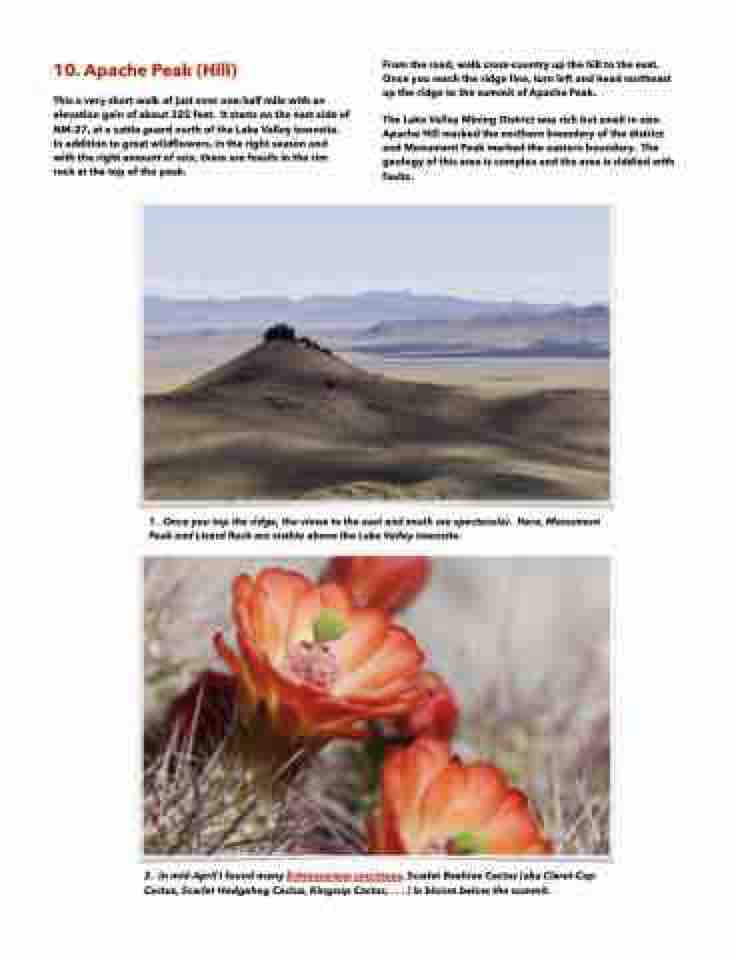
1. Once you top the ridge, the views to the east and south are spectacular. Here, Monument Peak and Lizard Rock are visible above the Lake Valley townsite.
2. In mid-April I found many Echinocereus coccineus, Scarlet Beehive Cactus (aka Claret-Cup Cactus, Scarlet Hedgehog Cactus, Kingcup Cactus, . . . ) in bloom below the summit.
