
Page 60 - Volume 3 - Walks In The Black Range
P. 60
16. Dry Creek
Dry Creek just west of Kingston is not always Dry. On the day of our walk (8/29/2014) the going was easy, floods had washed out any game trails, the creek bottom was rock and wet sand, and in places water still ran. Route finding is not an issue because the route follows the creek bed. The usual Black Range suspects are possible; rattlesnakes, Black Bears, Cougars, skunks, etc..
Just west of Iron Street at the west end of Kingston, New Mexico a creek enters from the south. This is “Dry Creek”. The first section of the creek, about 50 yards south from the road it is on private property, be respectful and follow appropriate protocols. A fence crosses the creek bed about 50 yards from the road and a sign indicates that you are entering USDA Forest Service land.
Limestone strata starts to appear in the creek bed after a short walk. This strata contains fossils (gastropods). Toward the end of the walk shown here the slopes were heavily burned by the Silver Fire. Dark dead snags were outlined by a beautiful blue sky. The slopes were covered with a mass of green and flowers.
On the day of our walk the creek banks were covered in wildflowers, butterflies cruised the “water course”, native bees were about and a gentle breeze blew down the canyon. Altogether a beautiful little stroll in the forest.
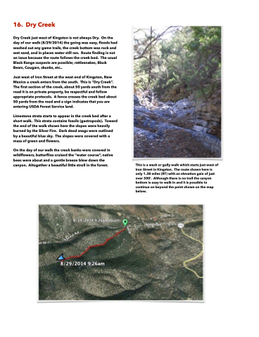
This is a wash or gully walk which starts just west of Iron Street in Kingston. The route shown here is only 1.38 miles (RT) with an elevation gain of just over 300’. Although there is no trail the canyon bottom is easy to walk in and it is possible to continue on beyond the point shown on the map below.
