
Page 74 - Volume 3 - Walks In The Black Range
P. 74
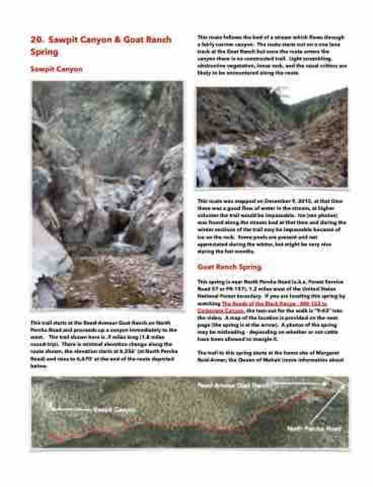
 20. Sawpit Canyon & Goat Ranch Spring
Sawpit Canyon
This route follows the bed of a stream which flows through a fairly narrow canyon. The route starts out on a one lane track at the Goat Ranch but once the route enters the canyon there is no constructed trail. Light scrambling, obstructive vegetation, loose rock, and the usual critters are likely to be encountered along the route.
    This trail starts at the Reed-Armour Goat Ranch on North Percha Road and proceeds up a canyon immediately to the west. The trail shown here is .9 miles long (1.8 miles round-trip). There is minimal elevation change along the route shown, the elevation starts at 6,356’ (at North Percha Road) and rises to 6,670’ at the end of the route depicted below.
This route was mapped on December 9, 2015, at that time there was a good flow of water in the stream, at higher volumes the trail would be impassable. Ice (see photos) was found along the stream bed at that time and during the winter sections of the trail may be impassable because of ice on the rock. Some pools are present and not appreciated during the winter, but might be very nice during the hot months.


Goat Ranch Spring
This spring is near North Percha Road (a.k.a. Forest Service Road 57 or FR-157), 1.2 miles west of the United States National Forest boundary. If you are locating this spring by watching The Roads of the Black Range - NM-152 to Carbonate Canyon, the turn-out for the walk is “9:43” into the video. A map of the location is provided on the next page (the spring is at the arrow). A photos of the spring may be misleading - depending on whether or not cattle have been allowed to mangle it.
The trail to this spring starts at the home site of Margaret Reid-Armer, the Queen of Mohair (more information about
