
Page 30 - Black Range Naturalist Vol 3 No 3 July 2020
P. 30
Forest Trail 796 - Kingston Cemetery to Emory Pass
It is 4.4 miles from the Kingston Cemetery to Emory Pass via Forest Service Trail 796. The elevation gain is just short of 2,000 feet. Although there are some fairly flat sections along the trail, most of it progresses up the mountain at a steady incline. (See elevation profile below.) The 8.8 mile round-trip can be easily done in a day or it may be done as a one-way walk with a car shuttle. It is best done during winter - snow is possible - or during the shoulder months, because sections of the trail (especially some of the lower sections) have very little shade since the Silver Fire.
See the map on the inside back cover for a location key to the items referenced below.
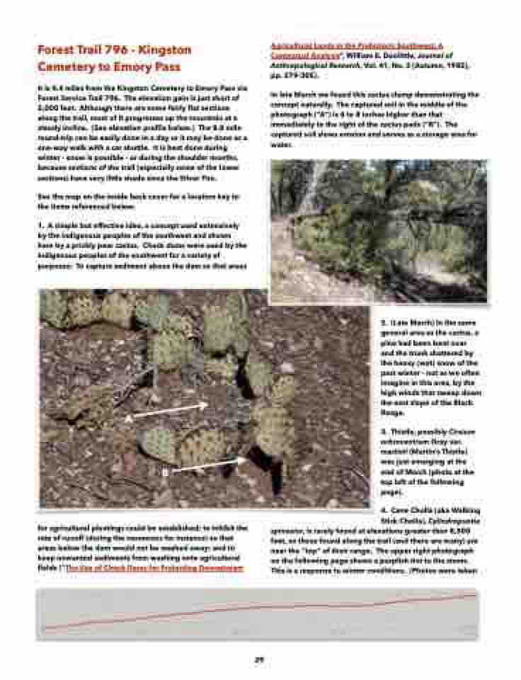
1. A simple but effective idea, a concept used extensively by the indigenous peoples of the southwest and shown here by a prickly pear cactus. Check dams were used by the indigenous peoples of the southwest for a variety of purposes: To capture sediment above the dam so that areas
Agricultural Lands in the Prehistoric Southwest: A Contextual Analysis”, William E. Doolittle, Journal of Anthropological Research, Vol. 41, No. 3 [Autumn, 1985], pp. 279-305).
In late March we found this cactus clump demonstrating the concept naturally. The captured soil in the middle of the photograph (“A”) is 6 to 8 inches higher than that immediately to the right of the cactus pads (“B”). The captured soil slows erosion and serves as a storage area for water.
A
B
for agricultural plantings could be established; to inhibit the rate of runoff (during the monsoons for instance) so that areas below the dam would not be washed away; and to keep unwanted sediments from washing onto agricultural fields (“The Use of Check Dams for Protecting Downstream
2. (Late March) In the same general area as the cactus, a pine had been bent over and the trunk shattered by the heavy (wet) snow of the past winter - not as we often imagine in this area, by the high winds that sweep down the east slope of the Black Range.
3. Thistle, possibly Cirsium ochrocentrum Gray var. martinii (Martin’s Thistle) was just emerging at the end of March (photo at the top left of the following page).
4. Cane Cholla (aka Walking
Stick Cholla), Cylindropuntia spinosior, is rarely found at elevations greater than 8,500
feet, so those found along the trail (and there are many) are near the “top” of their range. The upper right photograph on the following page shows a purplish tint to the stems. This is a response to winter conditions. (Photos were taken
29
