
Page 14 - Vol. 1 Walks In The Black Range - 2nd Edition
P. 14
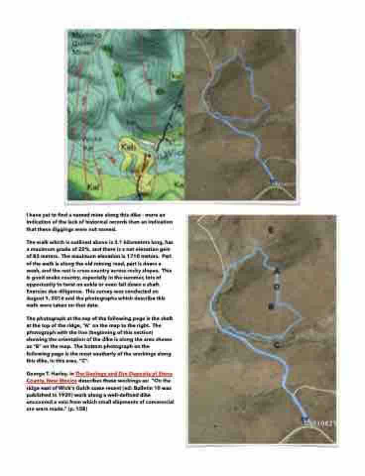
  I have yet to find a named mine along this dike - more an indication of the lack of historical records than an indication that these diggings were not named.
The walk which is outlined above is 3.1 kilometers long, has a maximum grade of 22%, and there is a net elevation gain of 83 meters. The maximum elevation is 1710 meters. Part of the walk is along the old mining road, part is down a wash, and the rest is cross country across rocky slopes. This is good snake country, especially in the summer, lots of opportunity to twist an ankle or even fall down a shaft. Exercise due diligence. This survey was conducted on August 1, 2016 and the photographs which describe this walk were taken on that date.
The photograph at the top of the following page is the shaft at the top of the ridge, “A” on the map to the right. The photograph with the line (beginning of this section) showing the orientation of the dike is along the area shown as “B” on the map. The bottom photograph on the following page is the most southerly of the workings along this dike, in this area, “C”.
George T. Harley, in The Geology and Ore Deposits of Sierra County, New Mexico describes these workings as: “On the ridge east of Wick's Gulch some recent (ed: Bulletin 10 was published in 1939) work along a well-defined dike uncovered a vein from which small shipments of commercial ore were made.” (p. 158)
