
Page 92 - Walks In The Black Range, Vol. 4
P. 92
14. Frying Pan Spring
The walk to Frying Pan Spring is surrounded by history. The walk is on the southwestern edge of the Cooke’s Range (which is treated as an extension of the Black Range here). It is a beautiful place, full of colorful flora (dozens of mature Desert Willows) and exotic fauna (Long-nosed Leopard Lizards). But it is the human history which sets this place apart. Additional photos on the Black Range website.
I first went to this area looking for petroglyphs (Mogollon Culture). I had a photograph of a glyph from somewhere and in the background there was some of the landscape. I knew the general location I would be looking at and figured out the approximate area I would be going to in my search for the glyphs. Getting there proved to be a bit of an issue. Eventually we figured out the route (not nearly as clear as the blue line on the map which follows, when you are on the ground); the road video to the area is shown here.
My first trips to the area were limited to exploring the petroglyph site. Photographs of the glyphs at that site may be seen on the ancientpeoples.org website.
As seen in the video (link above), the road into the Starvation Creek Check Dam left a lot to be desired at the time of these early visits. This month (May 2018) I have visited the area twice and found that the road had been smoothed out by a road grader and the trip in was quite easy. Note, however, that after the first rains the road will be in much worse shape with wash-outs of unknown significance.
The purpose of these last visits was to find the Frying Pan Spring site and clarify a bit of history.
From page 41 of Cooke’s Peak - Pasaron Por Aqui - A Focus on United States History in Southwestern New Mexico, by Donald Howard Couchman, 1990 - Cultural Resources Bulletin No. 7 of the United States Bureau of Land Management (26.1 MB):
"On November 17, 1846, Cooke (ed. - left Cooke’s Spring and) took up the march early but did not progress far because the guides reported no more water, except for
a small spring near the west end of the canyon (today named Frying Pan Spring) and the Rio Mimbres, another 18 miles away. Accordingly a halt was called by mid-morning. Of the march through the canyon, Cooke grumbled:
'Another bright morning, with a cold northwester (the wind has been shifting to the north dropping the temperature).
I marched to the southwest, up a winding valley and
over the ridge, down to near the verge of the open
prairie beyond; up a ravine to the right of the road
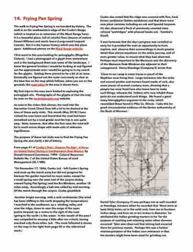
(going to the north ) is the water. In this mouth of the pass I was compelled to encamp a little after ten o’clock, having marched only three miles. (ed. - The route followed is shown on the map to the right from page 40 or the referenced work.)
Cooke also noted that the ridge was covered with fine, hard, brown sandstone (Sarten sandstone) and that there were new plant varieties including an oak and Spanish bayonet. He also observed a flock of previously unnoted slate- colored “partridges” with plumed heads (ed. - Gambel’s Quail).
It was fortunate that the day’s progress was curtailed so early for it provided the men an opportunity to hunt, explore, and observe their surroundings in much greater detail than almost anywhere on the entire journey, and of even greater value, to record what they had observed. Perhaps most important to the Mormons was the discovery of the Massacre Peak Mimbres site adjacent to their campground. Henry Standage (Company E) wrote that:
'Close to our camp is some traces or proof of the Nephites once living here. Large entrances into the rocks and several pestles and mortars found made of rock, also some pieces of ancient crockery ware, showing that a people has once lived here who knew how to make
such things, whereas the Indians who now inhabit these parts do not understand such things. We found a great many hieroglyphics engraven in the rocks, which resembled those found in Pike Co. Illinois. I take this for good circumstantial evidence of the Divine authenticity of the Book of Mormon.'
Daniel Tyler (Company C) was perhaps not as well rounded as Standage, because when he recorded that 'there were at least thirty holes cut in the solid rock, from ten to fourteen inches deep, and from six to ten inches in diameter,' he attributed the Indian grinding mortars to be 'for the purpose of catching and retaining water when showers occurred.’ Tyler also observed that mining had occurred there for precious metals. Perhaps this was a further misinterpretation of the Indian cave entrances or that
the mortars might have been used for grinding ore.
