
Page 14 - GTI Annual Report 2019
P. 14
Much of what we do involves digitizing field data collection and integrating it with geospatial data
Much of what we do involves digitizing field data collection and integrating it with geospatial data
Much of what we do involves digitizing field data collection and integrating it with geospatial data
Safe, Reliable, Resilient Much of what we do involves digitizing field data collection and integrating it with geospatial data
Much of what we do involves digitizing field data collection and integrating it with geospatial data
Infrastructure Much of what we do involves digitizing field data collection and integrating it with geospatial data
Much of what we do involves digitizing field data collection and integrating it with geospatial data
Much of what we do involves digitizing field data collection and integrating it with geospatial data
Much of what we do involves digitizing field data collection and integrating it with geospatial data
A safe, reliable, and resilient infrastructure is critical Much of what we do involves digitizing field data collection and integrating it with geospatial data
Much of what we do involves digitizing field data collection and integrating it with geospatial data
to match abundant energy supplies with growing Much of what we do involves digitizing field data collection and integrating it with geospatial data
demand to maintain the public’s confidence in the Much of what we do involves digitizing field data collection and integrating it with geospatial data
Much of what we do involves digitizing field data collection and integrating it with geospatial data
nation’s energy delivery systems. Much of what we do involves digitizing field data collection and integrating it with geospatial data
Much of what we do involves digitizing field data collection and integrating it with geospatial data
Much of what we do involves digitizing field data collection and integrating it with geospatial data
Much of what we do involves digitizing field data collection and integrating it with geospatial data
Much of what we do involves digitizing field data collection and integrating it with geospatial data
Gas utilities need optimized tools and technologies to effectively Much of what we do involves digitizing field data collection and integrating it with geospatial data
manage and improve day-to-day operations, prevent damage, reduce Much of what we do involves digitizing field data collection and integrating it with geospatial data
risk, and enhance safety.
GTI provides information technology and digital
platform solutions to help utilities automate their
collection of high-quality data to inform effective Tools
decision making. We are helping increase the ---------------
understanding of infrastructure threats and enabling
operators to improve the accuracy of inspections, Collaborating with Esri to develop electronic field
predict asset performance, and calculate system risk. data collection forms using Survey123 to streamline
record-keeping workflow
---------------
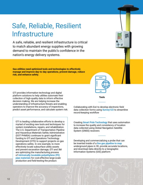
GTI is leading collaborative efforts to develop a Creating Smart Pole Technology that uses automation
myriad of exciting new tools and techniques for to increase the quality and consistency of location
system installations, repairs, and rehabilitation. data collected using Global Navigation Satellite
The U.S. Department of Transportation Pipeline System (GNSS) receivers
and Hazardous Materials Safety Administration
(DOT PHMSA) continues to grant significant ---------------
funding to GTI and Operations Technology
Development (OTD) to support projects on gas Developing and commercializing a probe that can
operations safety. In one example, to more be inserted inside of a live gas pipeline to map
effectively locate subsurface utility assets underground pipes in 3D, provide accurate locations,
and prevent excavation damage, GTI and 3M and download data directly to a Geographic
are optimizing the manufacturing process Information Systems (GIS) platform
of intrinsically locatable polyethylene (PE)
pipe materials for cost-effective large-scale
production and field-testing the product.
12