
Page 14 - 605 Deer Mountain
P. 14
Assessor's Map Number
038-13
BLUE HERON PARK
STATE OF NEVADA
SUBDIVISION UNIT 1
Ê
ASSESSOR'S OFFICE
PORTION S 1/2 SEC. 16,
Michael E. Clark, Assessor
T19N - R18E
1001 East Ninth Street
Building D
Reno, Nevada 89512
(775) 328-2231
BOOMTOWN GARSON RD.
U.S. INTERSTATE 80
2
123.12
416.09
038-133-15
1
100
313.97
238.09
280.0
259.06
038-133-16
92.61
133
220.13
1.4 ac.
7
5
4.0
60
290.17
4
7
161.97
CIRCLE
038-133-09
143.09
83.28 45.38
3
038-133-10
195.91
B
Feet
1.19 ac.
A
41.97
038-133-11
038-133-04
151.13
1.11 ac.
038-133-12
187.01
76.05 215.49
160
1.08 ac.
395.14
.90 ac.
0
300
75
150
225
038-133-13
220.0
1.05 ac.
236.44
79.58
103.84
220.12
1 inch = 300 feet
1.08 ac.
038-133-14
426.44
038-132-19
31.60
345.0
190.0
220.0
93.0
1.02 ac.
.567 ac.
5
200.0
217.7
224.57
7 038-133-01
038-134-06 038-134-07
241.86
167.58
250.0
35.33
6
1.22 ac.
038-134-05
222.0
216.41
.96 ac.
221.78
201.33
40
PAR.
250.0
205.0
038-134-04
1
.96 ac.
7
A
43.95
190.85
27.23
5
038-134-03
4
6
1.11 ac.
227.73
180.0
234.02
038-133-02
270.0
038-134-02
228.72
190.21
038-134-01
POR.
.99 ac.
Sparks
8
200.99
3
.99 ac.
.96 ac.
9
1.66 ac.
155.0
251.25
PAR.A
LANE
251.25
Reno
320.5
303.2
199.47
C11
038-134-08
155.8
240.43
P.M. 2502
393.45
13
12
250.0
DEER MT. RD.
038-134-13
1.282 ac.
038-134-10
192.73
038-134-11
038-132-18
1.17 ac.
038-134-12
ORD.5264 151.62 105.70 88.52 297.31 264.31 BLUE 156.51 163.2 2 1.11 ac. 1 52.1 HERON 2 (#749) 134 10 225.0 038-134-09 171.25 6 151.62 220.0 168.95 038-133-03 210.0 4 2.33 ac. 2.04 ac. 190.0 3 16 15 WASHOE COUNTY
1.08 ac.
1.11 ac.
45.02
75 135.6 140.0 157.87 1.02 ac. 1.22 ac. 213.38 228.06 143.22 120.0 1.02 ac.
251.13
320.0 163.78 54.45 1
86.84 WARRIOR 90.91 121.11 137.54 200.45 176.18 41.58 99.8 224.56 038-132-13
OLD TOWN RD.
DM
50 234.68 200.0 184.7 1.02 ac. 219.99
038-132-04 15.31 190.13 169.88 180.4 163.89 164.93 224.39 224.76 038-132-17
Deer Mountain Road
1.11 ac. 038-132-05 038-132-07 10.5 242.13 265.15 038-132-12 200.0 1.01 ac. 200.0
225.71 1.03 ac. 224.84 038-132-06 .96 ac. 038-132-08 038-132-10 1.25 ac. 10 200.0
1.03 ac.
224.0
237.0
1 3D 230.09 .96 ac. 038-132-09 254.19 038-132-11 038-132-14 DEER MT. RD. E 219.99 2 038-87
90 200.0 2 .99 ac. .93 ac. .99 ac. 307.8 196.02 038-43
200.0 4 1.11 ac. 038-88
190.0 180.0 5 180.0 6 7 9 220.0 038-132-16
1463.03 163.52 158.23 8 101.25 11 1.07 ac. 038-14
City of Reno
1355.03 132 265.89 196.87 221.88 3 225.74 038-12 038-56
038-13
221.59
038-65
POR. NEVA RD.
PAR.C
332.66 P.M. 3068 038-19 038-67
341.04 R/S 3177 303.60
038-132-32
038-132-25 1.605 ac.
53.645 ac. City of Reno 50
529.69 46.56 8.38 219.86 Å
529.69
Washoe County 12.5 37.5 R/S 3177
POR.
PAR.B
P.M.3068
CFB 09/23/2014
R.S.3177 509.49 created by: __________________________
CFB 11/23/2015
452.90 452.90 038-132-30 499.52 499.52 038-132-31 last updated: _________________________
149.48 16 City of Reno Steamboat Ditch 5.695 ac. 3.00 ac. area previously shown on map(s)
Ê
21 1811.57 ____________________________________
Washoe County
550.87 NOTE: This map was prepared for the use of the
550.87
257.66 16 15 Washoe County Assessor for assessment and
Ê
Ê
21 22 illustrative purposes only. It does not represent
a survey of the premises. No liability is assumed
as to the sufficiency or accuracy of the data
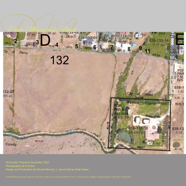
Particulars Prepared December 2017 delineated hereon.
Photography By In1View
Design and Production By Nicole Merwin, L. Lance Gilman Real Estate
All information is for guidance only and should not be relied upon as sole representatioin of fact or current property condition. Prospective buyers should verify all information.