
Page 28 - ATD 03OCT,2015
P. 28
A28
SCIENCESaturday 3 October 2015
Hurricane and rainstorm are locked in a dangerous dance
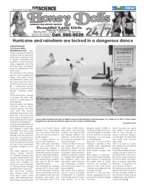
SETH BORENSTEIN A man wades through flood water on Atlantic Avenue during high tide in Wachapreague, Va., Friday, Oct. 2, 2015. A storm system
AP Science Writer brought heavy rain and wind into the region as well as major coastal flooding.
WASHINGTON (AP) — Hur-
ricane Joaquin is locked in Associated Press
a dance with an extraordi-
narily heavy rainstorm that seen in the South, where 1,000 miles (1,600 kilome- pressure system 10,000 to Some forecasts see spots
is already drenching the flooding has submerged ters) away. And because 12,000 feet high that is un- with nearly a foot and a
Carolinas. As the two draw cars, shut down roads and Joaquin can keep funnel- usual and deep for this time half of rain, enough to
closer together over the led to at least one death in ing tropical moisture into of year. And it’s not moving cause extremely danger-
next few days, the effects South Carolina. storm No. 1 from afar, even anywhere, so it can keep ous flooding, the kind that
could be disastrous for the It’s a messy picture, no an out-to-sea Joaquin can on dumping rain. can push cars around,
East Coast. matter what happens. worsen flooding. Storm No. 1 stretches from Maue said.
The rainstorm is the dance “The worst-case scenarios “I know we like to focus on Florida to Canada on the “This is as bad as it gets.
partner that is leading this are very worrisome, and the hurricane,” said Da- weather map, resembling This is going to be historical
tango, and what it does the best-case scenario is vid Novak, director of the a giant hockey stick. flooding,” he said.
will determine where Joa- pretty bad even without a National Oceanic and At- That makes Joaquin the One of the problems in fore-
quin goes and how much landfall because of the rain mospheric Administration’s puck. casting Joaquin is that for a
of the coast floods. Storm threat,” said Marshall Shep- Weather Prediction Center Ryan Maue, a meteorolo- powerful storm, it isn’t mov-
No. 1 could push Joaquin herd, a University of Geor- in College Park, Maryland. gist at the private Weather ing much at the moment.
out to sea or pull it into the gia meteorology professor But whatever track Joa- Bell Analytics, is predicting It’s sort of adrift, and that’s
heavily crowded North- and host of the TV show quin takes, “we’re becom- the entire state of South kind of unusual, said Brian
east. “Weather Geeks.” ing increasingly confident Carolina will average 10 McNoldy, a researcher at
At the same time, Joaquin Meteorologists are warning and concerned about the inches of rain, while North the University of Miami.
is feeding the storm with people not to focus solely heavy rainfall.” Carolina and Maryland will The hurricane center said it
moisture, contributing to its on the hurricane’s position. The system that is drench- average 7 inches. expects the storm to gain a
torrential rain. Streets and homes can still ing the coast is a strange Novak is a little less rain- bit more strength, thanks to
Meteorologists are deeply get walloped with rain and combination of conditions heavy, saying parts but not record warm water, before
uncertain about where flooding associated with that Novak said he hasn’t all of South Carolina will get weakening in the Atlantic’s
Joaquin will go. But they the hurricane even if it is seen before. It’s a low- 10 inches. colder reaches.q
warn that the record-
breaking downpours from
storm No. 1 are a sure and
scary thing, at least for an
area stretching from South
Carolina to Washington.
Joaquin strengthened over
the Bahamas into a power-
ful Category 4 storm with
130 mph (210 kph) winds
Thursday, and computer
models over the past two
days have switched back
and forth, sometimes show-
ing it blowing ashore along
the East Coast, sometimes
showing it peeling out to
sea.
The latest National Hur-
ricane Center forecast
on Thursday evening had
Joaquin continuing to veer
away from the Southeast
coast and heading to-
ward the Cape Cod area
of Massachusetts, though
probably more eastward.
The out-to-sea scenario
was looking more and
more likely, which could
spare the Northeast from
drenchings as bad as those