
Page 30 - DSA4_B_2book2
P. 30
The Amite River Basin Watershed occupies 1,884 square miles and covers portions of
seven parishes in Louisiana (including Livingston Parish) and two counties in
Mississippi. The Amite and Comite Rivers converge in the City of Denham Springs.
This river convergence coupled with heavy rains and hurricanes have resulted in
multiple flood events in the City of Denham Springs over the years.
The previous flood of record in April 1983 occurred when approximately 10 inches of
rain flooded 3,025 homes in Livingston Parish. In August 2016 over 24 inches of rain
fell in Denham Springs causing greater devastation.
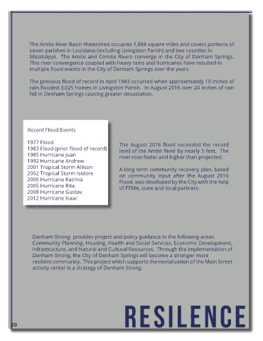
Recent Flood Events
1977 Flood The August 2016 flood exceeded the record
1983 Flood (prior flood of record) level of the Amite River by nearly 5 feet. The
1985 Hurricane Juan river rose faster and higher than projected.
1992 Hurricane Andrew
2001 Tropical Storm Allison A long term community recovery plan, based
2002 Tropical Storm Isidore on community input after the August 2016
2005 Hurricane Katrina Flood, was developed by the City with the help
2005 Hurricane Rita of FEMA, state and local partners.
2008 Hurricane Gustav
2012 Hurricane Isaac
Denham Strong provides project and policy guidance in the following areas:
Community Planning, Housing, Health and Social Services, Economic Development,
Infrastructure, and Natural and Cultural Resources. Through the implementation of
Denham Strong, the City of Denham Springs will become a stronger more
resilient community. This project which supports the revitalization of the Main Street
activity center is a strategy of Denham Strong.
resilence
29