
Page 227 - Green - Maritime Archaeology: A Technical Handbook. 2nd ed
P. 227
206 Maritime Archaeology: A Technical Handbook, Second Edition
be possible to utilize the large-scale plan in the publication in a reduced form. For example, if line thicknesses are small in the original, they can dis- appear in reduction, thus requiring the plan to be redrawn. To some extent, the use of computer-based plans can resolve this problem, provided the archaeologist is comfortable working on a computer rather than a hard copy.
II. RASTER GRAPHIC PACKAGES
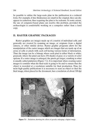
Raster graphics are images made up of a matrix of individual cells, and generally are created by scanning an image, or originate from a digital camera, or other similar device. Raster graphic programs allow for the manipulation of the raster images, which are images that are made up of an array of cells or pixels with each cell having various forms of information. Thus, the image can be a bitmap, where each pixel is either black or white; grayscale, where the pixel can have 256 shades of gray; or a variety of color options. If a raster image is enlarged, the pixels get larger, resulting in what is usually called pixilation (Figure 7.1). It is important when creating raster images to consider what the final scale is going to be and to ensure that the object is recorded at a resolution suitable for final production. Thus, for most high-quality publications it is necessary to scan an object so that the final image, when placed in the document, has a resolution of about 300 dpi
Figure 7.1 Pixilation, showing the effect of greatly enlarging a digital image.
