
Page 53 - Green - Maritime Archaeology: A Technical Handbook. 2nd ed
P. 53
32 Maritime Archaeology: A Technical Handbook, Second Edition
a
b
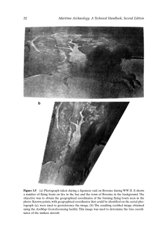
Figure 3.5 (a) Photograph taken during a Japanese raid on Broome during WW II. It shows a number of flying boats on fire in the bay and the town of Broome in the background. The objective was to obtain the geographical coordinates of the burning flying boats seen in the photo. Known points, with geographical coordinates that could be identified on the aerial pho- tograph (a), were used to georeference the image. (b) The resulting rectified image obtained using the ArcMap Georeferencing facility. This image was used to determine the true coordi- nates of the sunken aircraft.
