
Page 96 - Green - Maritime Archaeology: A Technical Handbook. 2nd ed
P. 96
Chapter 3: Search and Survey 75
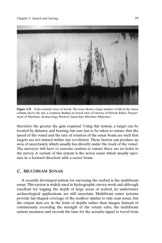
Figure 3.31 Echo sounder trace of wreck. The trace shows a large number of fish in the water column above the site, a common finding on wreck sites. (Courtesy of Patrick Baker, Depart- ment of Maritime Archaeology, Western Australian Maritime Museum.)
therefore the greater the gain required. Using this system, a target can be located by distance and bearing, but care has to be taken to ensure that the speed of the vessel and the rate of rotation of the sonar beam are such that targets are not missed within one revolution. These factors can produce an area of uncertainty, which usually lies directly under the track of the vessel. The surveyor will have to exercise caution to ensure there are no holes in the survey. A variant of this system is the sector sonar which usually oper- ates in a forward direction with a sector beam.
C. MULTIBEAM SONAR
A recently developed system for surveying the seabed is the multibeam sonar. This system is widely used in hydrographic survey work and although excellent for logging the depth of large areas of seabed, its underwater archaeological applications are still uncertain. Multibeam sonar systems provide fan-shaped coverage of the seafloor similar to side scan sonar, but the output data are in the form of depths rather than images. Instead of continuously recording the strength of the return echo, the multibeam system measures and records the time for the acoustic signal to travel from
