
Page 97 - Green - Maritime Archaeology: A Technical Handbook. 2nd ed
P. 97
76 Maritime Archaeology: A Technical Handbook, Second Edition
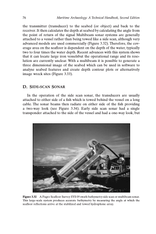
the transmitter (transducer) to the seabed (or object) and back to the receiver. It then calculates the depth at seabed by calculating the angle from the point of return of the signal Multibeam sonar systems are generally attached to a vessel rather than being towed like a side scan, although very advanced models are used commercially (Figure 3.32). Therefore, the cov- erage area on the seafloor is dependent on the depth of the water, typically two to four times the water depth. Recent advances with this system shows that it can locate large iron vesselsbut the operational range and its reso- lution are currently unclear. With a multibeam it is possible to generate a three dimensional image of the seabed which can be used in software to analyse seabed features and create depth contour plots or alternatively image wreck sites (Figure 3.33).
D. SIDE-SCAN SONAR
In the operation of the side scan sonar, the transducers are usually attached to either side of a fish which is towed behind the vessel on a long cable. The sonar beams then radiate on either side of the fish providing a two-way look (see Figure 3.34). Early side scan sonar had a single transponder attached to the side of the vessel and had a one-way look, but
Figure 3.32 A Fugro Seafloor Survey SYS 09 swath bathymetry side scan or multibeam sonar. This large-scale system produces accurate bathymetry by measuring the angle at which the seafloor reflections arrive at the stabilized and towed hydrophone array.
