
Page 32 - Kennemerland VOC ship, 1664 - Published Reports
P. 32
NAUTICAL ARCHAEOLOGY, 3.2
d a; o3:
such major artefacts as anchor 6 and cannon 7and 8. Search is inevitably associated with survey. It was felt that the published Ord- nance Survey maps of the site were in- adequate for our purposes, and so a new map of the whole of South Mouth has been produced. The principal features under- water were then related to this, using two on-shore theodolites and diver-held buoys. Greater precision was achieved for the main excavation area by means of underwater triangulation.
Objectives and methods are bzing con- sidered together in this section, since the latter are naturally dependent on the former. It is particularly important to remember this archaeological dictum where underwater excavation is concerned, in order to prevent it degenerating into uncontrolled looting. Our primary objective in excavation was to make the material yield up as much in- formation as possible about the type of goods which a Dutch East Indiaman of this period would be carrying as equipment, stores or cargo. Secondly, we wished to understand more about the process by which the vessel had disintegrated, and to compare this information with the Skerries folk-lore re- garding this subject (Bruce, 1907). Finally, we were interested in the factors which had led to the differential preservation of artefacts
3
\
I 2OUT km -\
258
\
\ SKERRIES
\ 7\
-= LONDON.
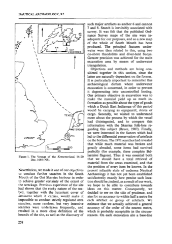
Figure 1. The Voyage of the Kennemerland, 14-20 Dec. 1664 (NS).
Nevertheless,we made it one of our objectives to conduct further searches in the South Mouth of the Out Skerries harbour in order to achieve greater certainty of the extent of the wreckage. Previous experience of the site had shown that the rocky nature of the sea- bed, together with the luxuriant cover of Iaminaria which it carries, would make it impossible to conduct strictly regulated area searches; more random, but very intensive searches were undertaken frequently, and resulted in a more close definition of the bounds of the site, as well as the discovery of
\
\
\
\
\
\
\
\\
\
\
\
\
\\
i AERDA
that while much material was broken and
100 200 km
greatly abraded, some items had survived perfectly (for example, three complete Bel- larmine flagons). Thus it was essential both that we should have a total retrieval of material from the areas examined, and that the position of every item be known. In the present infantile state of undersea Nautical Archaeology it has not yet been established satisfacrorily exactly how precise such loca- tion should be; indeed, as a result of our work, we hope to be able to contribute towards ideas on this matter. Consequently, we decided to err on the side of prudence, and aim for an accuracy to within half a metre for each artefact or group of artefacts. We estimate that we actually achieved a general accuracy of the order of the nearest metre, which is probably acceptable in the circum- stances. On each excavation site a base-line
on
the bottom.
archeshad revealed
The 1971 se
