
Page 17 - 2005 AMA Winter
P. 17
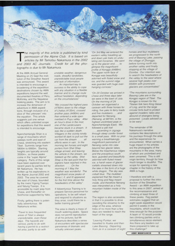
T he majority of this article is published by kind permission of the Alpine Club. It Is based on articles by Mr Tamotsu Nakamura in the 2002
and 2003 AC Journals. Credit for all the pho tographs is due to Mr Nakamura.
“On 3rd May we entered the eastern valley travelling up and down yak trails on undu lating old moraines. We went up to the glacier end to glimpse the magnificent profile of Kongga (6488m).
The upper north face of Kongga was beautifully adorned with fluted snow and ice, and the summit ridge was guarded with huge over hanging cornices."
“On 20 October we arrived in Lhasa and three days later we were in the town o f Jula. On the morning of 24 October we organised a caravan with three horses for riding, five yaks to ferry loads and five muleteers and departed for Nenang. (Nenang, at 6870m, is the highest unclimbed peak in Nyenchentangla East). We followed a yak trail
ascending in zigzags through steep conifer forest
to a small pass. With no prior warning a breathtakingly magnificent panorama of Nenang came into view beyond two glacier lakes. Below the treacherous ridges and the precipitous south face, guarded and beautifully adorned with fluted mixed
ice, a harsh wave of glacier icefalls streamed down into the lake in the form of a huge
white dragon. The sky was cobalt blue. The muleteer explained that Ne meant a holy thing and Nag meant inside, and therefore Nenang was interpreted as a holy mountain hidden inside of the valley”
The region is also accessible, in that it is possible to drive (avoiding the streams) to the edge of the area, whence treks of no more than a few days are needed to reach the heart of the range.
“Leaving Punkar, we travelled to Xueka and then Lake Basong. Departing from Je in a caravan of eight
horses and four muleteers we progressed to the north end of Basong Lake, passing the village of Zhonggo. before turning north into another valley and finally stopping at the village of Dzonba. Our intention was to search the headwaters of the valley to the west where several high peaks over 6500m with prominent glaciers are concentrated.”
"The mountains surrounding Basong Lake are in the Kongpo region o f Tibet. The Kongpo is known for the Tibetan folk hero King Gesar of Ling, and for the large circular forts built to protect against invaders: tales also abound of strangers being poisoned. Locals advised us to be wary.”
The remainder of Mr Nakamura’s narrative contains like descriptions of his journeys through the area and the experiences he encountered. What carries a huge impact in his articles are the photographs of the mountains in the area, many of which are unclimbed and even unnamed. This is still virgin territory, though for how much longer is doubtful. The scope for opening a new chapter in the history of the AMA is huge.
I therefore end with a proposal to further the intro duction of the Streather Award - an AMA expedition to this area in 2007, aimed at the reconnaissance and climbing at least three of these peaks. Fag packet estimates suggest that an eight week expedition would permit 5 weeks in the mountains, which could be time enough for the purpose. A team of 10 would provide two climbing parties and a simultaneous recce element. Are there any leaders out there prepared to take up this challenge?
At the AMA Annual General Meeting on 25 Sept the insti tution of the Streather Award was announced. This award Is Intended to encourage a broadening of the expedition destinations chosen by AMA expeditions beyond the well documented theatres of Peru, McKinley, and the Nepalese trekking peaks. The aim is to increase the dimension of adventure in AMA expedi tions, through inclusion of a slice of “the unknown" into
the equation. This article suggests just one venue which offers unlimited scope for expeditions that this award
is intended to encourage.
Nyenchentangla Shan is a range of mountains which sweeps north and east of Lhasa, stretching into eastern Tibet. Summits range from 5800m to 6900m. Starting heights are typically around 3500m+, so these peaks come in the “super Alpine” category. Parts of this range have been explored over recent years by parties led by Mr Nakamura. He has
written up his explorations in the Alpine Journal 2002 and 2003. The area he covered lies east of Lhasa, bounded by the rivers Yigong Tsanpo and Yalung Tsanpo. It is accessible by road/ jeep from Lhasa, and thereafter on foot/horse supported by Yaks.
Firstly, getting there is poten tially adventurous. Mr Nakamura writes:
“Travel to less frequented areas of Tibet is always unpredictable, even these days. The hazards are various, partly to do with having a permit to a restrict ed area, partly to do with
unstable weather, dangerous roads, dreadful landslides, unpredictable local people and lack of information.
An important key to success is the ability to cope with any situation in a flexible manner and to change route without hesitation, depending on the circumstances”
'We crossed the highest pass (4760m) down to the village of Lhatsa (4135m), crossed another pass (4490m) and then entered a wide open riverbed in Puyu valley. After an hour's drive in the mist, one of the Landcruisers became stuck in a stream. It was like a sudden death.
Villagers in the vicinity kindly worked till dark to pull out the car from the stream all efforts were in vain. In the morning ten horses and eight porters from Shel Shep village arrived, and leaving the vehicle in the stream, we trekked up the valley. Shel Shep is the last point that for eigners have reached in this direction On the morning of 1 May the
weather was wonderful. The magnificent snow peaks of Kona I, II, and III appeared for the first time above the headwaters of the valley”.
If Adventurous Training is to prepare Service personnel for operations, to be self reliant and respond to situations as they arise, could there be a better training ground?
The area is clearly a mass of mouth watering peaks. Space does not permit reproduction of all his pictures, but Mr Nakamura describes a series of encounters with spectacular panoramas of dramatic and virtually unknown peaks.
c
ARMY MOUNTAINS[R
