
Page 2 - book
P. 2
Digitizing in GIS is the process of converting geographic data either from a
hardcopy or a scanned image into vector data by tracing the features. During the
digitizing process, features from the traced map or image are captured as
coordinates in either point, line, or polygon format.
There are several types of digitizing methods. Manual digitizing involves
tracing geographic features from an external digitizing tablet using a puck (a type
of mouse specialized for tracing and capturing geographic features from the
tablet). Heads up digitizing (also referred to as on-screen digitizing) is the method
of tracing geographic features from another dataset (usually an aerial, satellite
image, or scanned image of a map) directly on the computer screen.
A shapefile is a simple, nontopological format for storing the geometric location
and attribute information of geographic features. Geographic features in a shapefile
can be represented by points, lines, or polygons (areas)
Creating a new shape file and digitizing
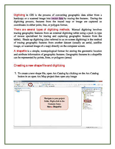
1. To create a new shape file, open Arc Catalog by clicking on the Arc Catalog
button in an open Arc Map project then open any image
Navigate to your project
folder. Right click in the
Contents frame
NewShapefile