
Page 167 - Atlas Sea Birds Ver1
P. 167
Rooipan, Yzerfontein Dassen Island
Coordinates: 33.3324 S; 18.1634 E Coordinates: 32.4245 S; 18.0880 E
Description: A pan to the north of Yzerfontein that holds Description: It is the largest of South Africa’s ‘guano’
water in some years. islands, which exclude the bigger Robben Island, and has
Conservation status: It is not protected. a surface area of 212 ha plus a 525 ha marine component
Species and numbers breeding: One Kelp Gull pair bred due to a 500 m extension around the island. It is mostly
at the pan in 1989 (Whittington et al. 2016). About 12 pairs flat rising to about 19 m above sea level in the south.
of Hartlaub’s Gull bred there in 1988 (Williams et al. 1990). A lighthouse is situated above this high point, with associated
None did so from 2006–2018 (DFFE unpublished records). buildings nearby (Rand 1963). The lighthouse is now
automated and not staffed permanently. There is a jetty and
Meeuwrots a settlement at the north of the island in House Bay, which
Coordinates: 33.3402 S; 18.1462 E lies between Boom Point to the northwest and a point at
Description: A rock about 500 m north of Yzerfontein the northeast, known as ‘Blaasbalk’, on which the Southern
Harbour. Arthur was wrecked. The Waterberg and Namaqua were
Conservation status: It is not protected. wrecked at the north and west of Boom Point, respectively;
Species and numbers breeding: Bank and White-breast- the J.F. Tunaman in House Bay; the New Mexico in the
ed cormorants bred at the rock. Details of numbers of pairs east; the Jack Stubbs, Tendeka and a wooden yacht on
Ichaboe Point in the southeast; and the Jenny Anne,
are given on the following table.
Sibanye and Fung Shung 22 in the southwest. The northern
settlement was formerly used as a base for guano scraping
and egg collecting. It now houses staff of CapeNature
Bank Cormorant White- Cormorant settlements. There was a lime kiln at the southeast in Lime
Year breasted and visiting researchers. A road links the north and south
island may form pans after good rains. Much of the island is
1975 16 Kiln Bay. Depressions on Boom Point and the centre of the
1979 26 sandy and covered with vegetation, which is especially lush
1991 11 in winter and spring. There are some bare rock patches
in the interior and several large boulders around the edge
1996 10 of the island. Much of the coastline is rocky but there are
1997 6 sandy beaches at House Bay, at West Bay in the southwest
2001 9 and at Whale Bay in the southeast.
2006 5 Many penguins nested in burrows made in sand
2011 1 (Kearton 1931, Crawford et al 2007b). Pelicans, Cape,
2012 0 White-breasted and Crowned cormorants nested on the
2013 2 ground. These cormorants also used rock piles and bred on
2014 0 some shipwrecks. Bank Cormorants nested on top of large
2015 3 0 boulders adjacent to the sea. The gulls and terns nested
on the ground. The distributions of pelican nesting areas
2016 12 0 were mapped for 1978–1994 and showed an expansion of
2017 5 0 breeding around Boom Point (Crawford et al. 1995a). The
2018 12 0 distributions of Kelp Gull nests were mapped for five years
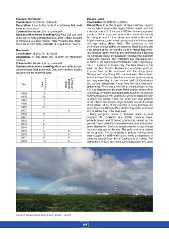
A view of Dassen Island looking south (photo L Upfold)
161