
Page 322 - demo
P. 322
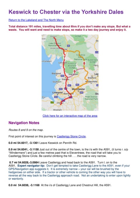
Keswick to Chester via the Yorkshire Dales


        Return to the Lakeland and The North Menu

        Total distance 191 miles, travelling time about 6hrs if you don’t make any stops. But what a
        waste.  You will want and need to make stops, so make it a two day journey and enjoy it.


                                     Click here for an interactive map of the area

        Navigation Notes


        Routes 8 and 9 on the map.


        First point of interest on this journey is Castlerigg Stone Circle.

        0.0 mi 54.6017, -3.1361 Leave Keswick on Penrith Rd.


        0.9 mi 54.6041, -3.1158 Just out of the centre of the town, is the i/s with the A591, (it turns r. s/p
        “Windermere”) and just a few metres past that is Eleventrees, the road that will take you to
        Castlerigg Stone Circle. Be careful climbing the hill . . . the road is very narrow.


         0.7 mi 54.6028,-3.0984 Leave Castlerigg and head back to the A591.  Turn l. on to the
        A591.  Expert navigator tip:  Don’t get tempted to take Castlerigg Lane to the A591, even if your
        GPS/Navigation app suggests it,  It is extremely narrow – your car will be brushed by the
        hedgerows on either side.  If a tractor or other vehicle is coming the other way you will have to
        reverse all the way back to the Castlerigg approach road.  Not an undertaking to enter upon lightly
        or wantonly.


        0.0 mi  54.6038, -3.1168  At the i/s of Castlerigg Lane and Chestnut Hill, the A591.