
Page 69 - JOJAPS_VOL13
P. 69
Isham Shah / JOJAPS – JOURNAL ONLINE JARINGAN PENGAJIAN SENI BINA
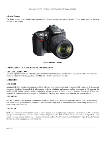
4. Digital Camera
The digital camera recorded and storing images in digital form. Many current models are also able to capture sound or video, in
addition to still images.
Figure 4 Digital Camera
5.4 LIMITATION OF MEASUREMENT AND RESEARCH
5.4.1 TIME LIMITATION
The most dependent limitation is the time given for the measurement activity and the overall assignment itself. Two weeks are
unable to complete the thoroughly because BIM is the very new software for students.
5.5 PROCESS
5.5.1 REVIT
Autodesk Revit is building information modeling software for architects, structural engineers, MEP engineers, designers and
contractors developed by Autodesk. It allows users to design a building and structure and its components in 3D, annotate the
model with 2D drafting elements, and access building information from the building model's database. Revit is 4D BIM capable
with tools to plan and track various stages in the building's lifecycle, from concept to construction and later demolition.
5.5.2 DRONE
A drone, in a technological context, is an unmanned aircraft. Essentially, a drone is a flying robot. The aircrafts may be remotely
controlled or can fly autonomously through software-controlled flight plans in their embedded systems working in conjunction
with onboard sensors and GPS
5.5.3 PIX4D
Pix4D is a solution to converting thousands of aerial images taken by lightweight, unmanned aerial vehicle (UAV) or aircraft
into geo-referenced 2D mosaics, 3D surface models and point clouds. With its advanced automatic aerial triangulation based
purely on image content and unique optimisation techniques, Pix4D software enables civilian light-weight drones to become
the next-generation mapping and surveying tool.
57 | V O L 1 3