
Page 70 - JOJAPS_VOL13
P. 70
Isham Shah / JOJAPS – JOURNAL ONLINE JARINGAN PENGAJIAN SENI BINA
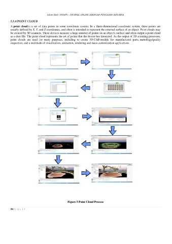
5.5.4 POINT CLOUD
A point cloud is a set of data points in some coordinate system. In a three-dimensional coordinate system, these points are
usually defined by X, Y, and Z coordinates, and often is intended to represent the external surface of an object. Point clouds may
be created by 3D scanners. These devices measure a large number of points on an object's surface and often output a point cloud
as a data file. The point cloud represents the set of points that the device has measured. As the output of 3D scanning processes,
point clouds are used for many purposes, including to create 3D CAD models for manufactured parts, metrology/quality
inspection, and a multitude of visualization, animation, rendering and mass customization applications.
Figure 5 Point Cloud Process
58 | V O L 1 3