
Page 33 - read
P. 33
iii. Using GIS-application to zoning forest for protection in Johor Tengah area.
With regard to forest management, GIS is an amazing tool because it answers crucial questions that help foresters in
forest management departments such as condition, location, modelling and trends make decisions. Other important fields
of forest management that have improved by GIS include forest monitoring, protection, harvest, conservation and
rehabilitation. It has also improved climate change and biodiversity. GIS enables foresters and other specialists to create
databases which are crucial in the preparation of work plans, wildlife conservation and soil conservation. Forest sectors
can improve their operations by using GIS in managing forests and other important sectors related to forestry.
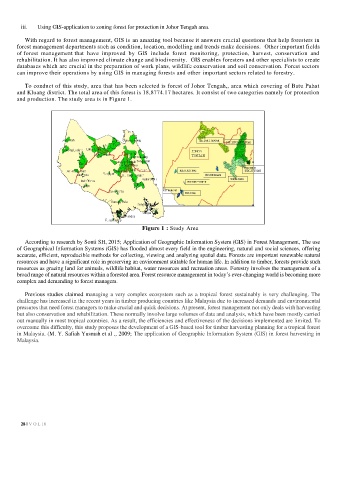
To conduct of this study, area that has been selected is forest of Johor Tengah,, area which covering of Batu Pahat
and Kluang district. The total area of this forest is 18,8774.17 hectares. It consist of two categories namely for protection
and production. The study area is in Figure 1.
Figure 1 : Study Area
According to research by Sonti SH, 2015; Application of Geographic Information System (GIS) in Forest Management, The use
of Geographical Information Systems (GIS) has flooded almost every field in the engineering, natural and social sciences, offering
accurate, efficient, reproducible methods for collecting, viewing and analyzing spatial data. Forests are important renewable natural
resources and have a significant role in preserving an environment suitable for human life. In addition to timber, forests provide such
resources as grazing land for animals, wildlife habitat, water resources and recreation areas. Forestry involves the management of a
broad range of natural resources within a forested area. Forest resource management in today’s ever-changing world is becoming more
complex and demanding to forest managers.
Previous studies claimed managing a very complex ecosystem such as a tropical forest sustainably is very challenging. The
challenge has increased in the recent years in timber producing countries like Malaysia due to increased demands and environmental
pressures that need forest managers to make crucial and quick decisions. At present, forest management not only deals with harvesting
but also conservation and rehabilitation. These normally involve large volumes of data and analysis, which have been mostly carried
out manually in most tropical countries. As a result, the efficiencies and effectiveness of the decisions implemented are limited. To
overcome this difficulty, this study proposes the development of a GIS-based tool for timber harvesting planning for a tropical forest
in Malaysia. (M. Y. Safiah Yusmah et al ., 2009; The application of Geographic Information System (GIS) in forest harvesting in
Malaysia.
28 | V O L 18