
Page 34 - read
P. 34
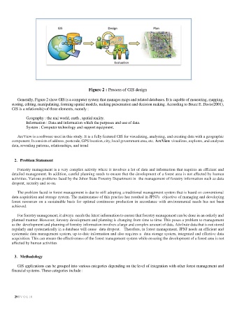
Figure 2 : Process of GIS design

          Generally, Figure 2 show GIS is a computer system that manages maps and related databases. It is capable of measuring, mapping,
       storing, editing, manipulating, forming spatial models, making presentation and decision making. According to Bruce E. Davis(2001),
       GIS is a relationship of three elements, namely :

              Geography : the real world, earth , spatial reality.
              Information : Data and information which the purposes and use of data.
              System : Computer technology and support equipment.

          ArcView is a software used in this study. It is a fully featured GIS for visualizing, analyzing, and creating data with a geographic
       component. It consists of address, postcode, GPS location, city, local government area, etc. ArcView visualizes, explores, and analyses
       data, revealing patterns, relationships, and trend


        2.  Problem Statement

          Forestry management is a very complex activity where it involves a lot of data and information that requires an efficient and
       detailed management. In addition, careful planning needs to ensure that the development of a forest area is not affected by human
       activities. Various problems faced by the Johor State Forestry Department in the management of forestry information such as data
       dropout, security and so on.

          The problem faced in forest management is due to still adopting a traditional management system that is based on conventional
       data acquisition and storage system. The maintenance of this practice has resulted in JPNJ's objective of managing and developing
       forest resources on a sustainable basis for optimal continuous production in accordance with environmental needs has not been
       achieved.

          For forestry management, it always needs the latest information to ensure that forestry management can be done in an orderly and
       planned manner. However, forestry development and planning is changing from time to time. This poses a problem to management
       as the development and planning of forestry information involves a large and complex amount of data. Attribute data that is not stored
       regularly and systematically in a database will cause data dropout.   Therefore, in forest management, JPNJ needs an efficient and
       systematic data management system, up-to-date information and also requires a  data storage system, integrated and effective data
       acquisition. This can ensure the effectiveness of the forest management system while ensuring the development of a forest area is not
       affected by human activities


        3.  Methodology

          GIS applications can be grouped into various categories depending on the level of integration with other forest management and
       financial systems. These categories include :


          29 | V O L 18