Page 207 - Geosystems An Introduction to Physical Geography 4th Canadian Edition
P. 207
Chapter 6 atmospheric and Oceanic Circulations 171
North Atlantic and Arctic oscillations
A north–south fluctuation of atmospheric variability marks the North Atlantic Oscillation (NAO), as pressure differences between the Icelandic Low and the Azores High in the Atlantic alternate from a weak to a strong pressure gradient. The NAO is in its positive phase when a strong pressure gradient is formed by a lowerthan normal Icelandic lowpressure system and a higherthan normal Azores highpressure cell (review their location in Figure 6.10). Under this scenario, strong westerly winds and jet streams cross the eastern Atlantic. In the eastern United States, winters tend to be less severe in contrast to the strong, warm, wet storms hitting northern Europe; however, the Mediterranean region is dry.
In its negative phase, the NAO features a weaker pres sure gradient than normal between the Azores and Iceland and reduced westerlies and jet streams. Storm tracks shift southward in Europe, bringing moist conditions to the Mediterranean and cold, dry winters to northern Europe. The eastern United States experiences cold, snowy winters as Arctic air masses plunge to lower latitudes.
The NAO flips unpredictably between positive and negative phases, sometimes changing from week to week. From 1980 to 2008, the NAO was more strongly positive; however, through 2009 and into early 2013, the NAO was more strongly negative (see www.ncdc.noaa.gov/ teleconnections/nao/).
Variable fluctuations between middle and high latitude air mass conditions over the Northern Hemi sphere produce the Arctic Oscillation (AO). The AO is associated with the NAO, especially in winter, and their phases correlate. In the AO positive, or warm, phase (positive NAO), the pressure gradient is affected by lower pressure than normal over the North Pole region and relatively higher pressures at lower latitudes. This sets up stronger westerly winds and a consistently strong jet
stream as well as the flow of warmer Atlantic water cur rents into the Arctic Ocean. Cold air masses do not mi grate as far south in winter, whereas winters are colder than normal in Greenland.
In the AO negative, or cold, phase (negative NAO), the pattern reverses. Higherthannormal pressure is over the polar region, and relatively lower pressure is over the central Atlantic. The weaker zonal wind flow during the winter allows cold air masses into the eastern United States, northern Europe, and Asia, and sea ice in the Arctic Ocean becomes a bit thicker. Greenland, Siberia, northern Alaska, and the Canadian Archipelago are all warmer than normal.
The Northern Hemisphere winter of 2009–2010 fea tured unusual flows of cold air into the midlatitudes. As temperatures dropped in the U.S. Northeast and Midwest, the circumpolar region was experiencing con ditions 15 to 20 C° above average. In December 2009, the AO was in its most negative phase since 1970; it was even more negative in February 2010 (see nsidc.org/arcticmet/ patterns/arctic_oscillation.html).
Recent research shows that melting sea ice in the Arc tic region may be forcing a negative AO. As sea ice melts, the open ocean retains heat, which it releases to the atmo sphere in the fall, warming the Arctic air. This reduces the temperature difference between the poles and the midlatitudes, and reduces the strength of the polar vor tex, strong wind patterns that trap arctic air masses at the poles. Weakening of the polar vortex causes a weaker jet stream, which then meanders in a north–south direction. This forces a negative AO, leading to mostly colder win ters over the Northern Hemisphere and the presence of a blocking highpressure system over Greenland. Figure HD 6, The Human Denominator, illustrates this phenom enon, as well as other examples of interactions between humans and Earth’s circulation patterns.
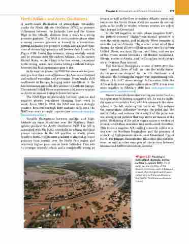
◀Figure 6.23 Flooding in Queensland, Australia, during
La Niña in January 2011. Flood water covers a section of the ipswich motorway, west of Brisbane, a result of prolonged rainfall asso- ciated with la niña conditions in the Pacific. [Tim Wimborne/reuters/ Corbis.]


