Page 709 - Geosystems An Introduction to Physical Geography 4th Canadian Edition
P. 709
 Appendix A: Maps in This Text and Topographic Maps A-4
  (a)
   83x
6
(b)
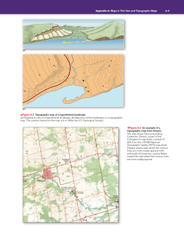
▲Figure A.5 Topographic map of a hypothetical landscape.
(a) Perspective view of a hypothetical landscape. (b) Depiction of that landscape on a topographic map. The contour interval on the map is 6 m. [After the U.S. Geological Survey.]
  ◀Figure A.6 An example of a topographic map from Ontario.
The area shown here surrounding Creemore, Ontario, is part of the Collingwood map sheet, number 41 A/8, from the 1:50 000 National Topographic System (NTS) map series. Steeper slopes exist where the contour lines are more closely spaced north and south of Creemore. Land is flatter toward the east where the contour lines are more widely spaced.
    78
78
60
6
60
30
30
6


