
Page 26 - Redditch SuDS DESIGN & EVALUATION
P. 26
6.0 Local SuDS requirements for
Local SuDS requirements
Redditch
Landscape character worcestershire.gov.uk/GI and a landscape
character assessment mapping portal can be
North Worcestershire generally can be found at http://gis.worcestershire.gov.uk/
characterised as a rolling agricultural and website/LandscapeCharacter. The web based
wooded landscape in which sandstones are mapping tool produced for the Minerals Local
marked by low hills and the softer rocks by Plan might also proof a useful source of
the valleys. The contrast of hard rocks to the information http://gis.worcestershire.gov.uk/
north and west and the softer rock in the Website/MineralsLocalPlan/
central areas give North-Worcestershire the
appearance of being a shallow basin
surrounded by a rim of higher ground, Local Geology
forming the catchment of the River Severn
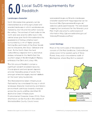
and its tributaries, the Stour, Salwarpe and Most of the north-west of Worcestershire
Avon. To the North-West the hard consists of Old Red Sandstone. Carboniferous
Carboniferous deposits form a distinctive strata occur in the western parts of Wyre
plateau whereas to the North-East the Forest Area, and in the extreme north of
southern edge of the Birmingham Plateau Bromsgrove, where they form a western
21 embraces the Clent and Lickey Hills.
The hills around Redditch contain a
significant ancient woodland resource.
Fluvial-glacial sand and gravel deposits
provide interesting areas of acidic flora
amongst otherwise largely neutral habitats
on the lower lying mudstones.
The Worcestershire Green Infrastructure
Partnership has considered the way in which
landscape character, biodiversity and historic
environment contribute towards character
across the county and has identified 30
distinctive Green Infrastructure
Environmental Character Areas (ECA). More
information can be found on the website of
Worcestershire County Council www.
Redditch Borough Council SuDS D & E Guide © 2018 McCloy Consulting & Robert Bray Associates